
IMAGES TAKEN NEAR TO
Tamworth Drive, FLEET, GU51 2UP
Introduction
This page details the photographs taken nearby to Tamworth Drive, GU51 2UP by members of the Geograph project.
The Geograph project started in 2005 with the aim of publishing, organising and preserving representative images for every square kilometre of Great Britain, Ireland and the Isle of Man.

There are currently over 7.5m images from over14,400 individuals and you can help contribute to the project by visiting https://www.geograph.org.uk
Image Map
Images are licensed for reuse under creativecommons.org/licenses/by-sa/2.0
Notes
- Clicking on the map will re-center to the selected point.
- The higher the marker number, the further away the image location is from the centre of the postcode.
Image Listing (51 Images Found)
Images are licensed for reuse under creativecommons.org/licenses/by-sa/2.0
Image
Details
Distance
2
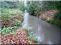
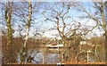
River Hart (Eastern Arm): Downstream of Fleet Pond
This is the view looking downstream from just downstream of the Old Cove Road bridge, and a short distance downstream of Fleet Pond. The watercourse is a tributary of the main River Hart which rises in Crondall and runs through Dogmersfield and Elvetham.
This long straight reach looks as if it has been rerouted with all the road development that has gone on in the vicinity, but this is not the case because the 1871 large scale Ordnance Survey map shows the same alignment in the same location.
Image: © Nigel Cox
Taken: 31 Jan 2016
0.08 miles
3
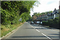
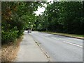
A3013 heading north
At the roundabout ahead the A3013 turns right towards Farnborough, the straight ahead road becomes the B3013.
Image: © Robin Webster
Taken: 11 Aug 2019
0.15 miles
4
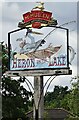
Sign for the Heron on the Lake
See Image] for public house.
Image: © JThomas
Taken: 27 Jul 2022
0.15 miles
8
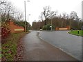
Fleet: B3013 Minley Road, Elvetham Heath Way & Ancells Road roundabout (2)
The Ordnance Survey 156000 Northing grid line bisects the roundabout, to the right here, so Image] is in the grid square to the north.
Image: © Nigel Cox
Taken: 31 Jan 2016
0.21 miles
10
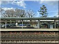
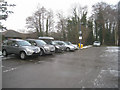
Fleet station
A gated entrance has been installed in the past few years.
Image: © Fernweh
Taken: 8 Apr 2022
0.22 miles