IMAGES TAKEN NEAR TO
Long Common, GUILDFORD, GU5 0TG
Introduction
This page details the photographs taken nearby to Long Common, GU5 0TG by members of the Geograph project.
The Geograph project started in 2005 with the aim of publishing, organising and preserving representative images for every square kilometre of Great Britain, Ireland and the Isle of Man.

There are currently over 7.5m images from over14,400 individuals and you can help contribute to the project by visiting https://www.geograph.org.uk
Image Map
Images are licensed for reuse under creativecommons.org/licenses/by-sa/2.0
Notes
- Clicking on the map will re-center to the selected point.
- The higher the marker number, the further away the image location is from the centre of the postcode.
Image Listing (22 Images Found)
Images are licensed for reuse under creativecommons.org/licenses/by-sa/2.0
Image
Details
Distance
1
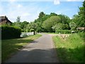
Junction of bridleway 330 (foreground) with drive to Hullbrook Court (centre right)
Image: © Andrew Longton
Taken: 6 Jun 2006
0.09 miles
2
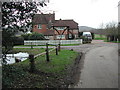
Hullhatch House and pond
Seen from the drive to Hullbrook Court, with bridleway Wonersh 330 crossing in front of Hullhatch House.
Image: © Hugh Craddock
Taken: 7 Feb 2007
0.09 miles
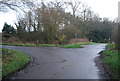
4
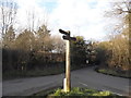
Junction on Longbrook Lane, Shamley Green
Image: © David Howard
Taken: 28 Feb 2016
0.11 miles
5
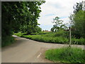
Hullbrook Lane, Shamley Green
Hullbrook Lane forms part of the route of National Cycle Network route 22 as it enters the village of Shamley Green. The small blue route marker is just visible, attached to the wooden signpost.
Image: © Malc McDonald
Taken: 3 Jun 2022
0.11 miles
6
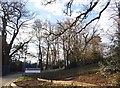
The entrance to Longacre School on Hullbrook Lane
Image: © David Howard
Taken: 28 Feb 2016
0.12 miles
7
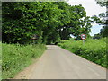
Hullbrook Lane, Shamley Green
Hullbrook Lane entering the village of Shamley Green in Surrey. Here, the speed limit changes to 20 miles per hour.
Hullbrook Lane is on route 22 of the National Cycle Network.
Image: © Malc McDonald
Taken: 3 Jun 2022
0.12 miles
8
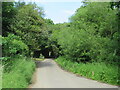
Lordshill Road, Shamley Green
Lordshill Road on the edge of the village of Shamley Green in Surrey. This section of road forms part of route 22 of the National Cycle Network.
Image: © Malc McDonald
Taken: 3 Jun 2022
0.12 miles
9
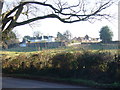
Hullbrook House
Landmark hilltop house seen from Hullbrook Lane, Shamley Green.
Image: © Colin Smith
Taken: 28 Dec 2008
0.14 miles