
IMAGES TAKEN NEAR TO
Shere Road, GUILDFORD, GU4 8SQ
Introduction
This page details the photographs taken nearby to Shere Road, GU4 8SQ by members of the Geograph project.
The Geograph project started in 2005 with the aim of publishing, organising and preserving representative images for every square kilometre of Great Britain, Ireland and the Isle of Man.

There are currently over 7.5m images from over14,400 individuals and you can help contribute to the project by visiting https://www.geograph.org.uk
Image Map
Images are licensed for reuse under creativecommons.org/licenses/by-sa/2.0
Notes
- Clicking on the map will re-center to the selected point.
- The higher the marker number, the further away the image location is from the centre of the postcode.
Image Listing (15 Images Found)
Images are licensed for reuse under creativecommons.org/licenses/by-sa/2.0
Image
Details
Distance
1

Woodland avenue
Walkers heading from Newlands Corner to West Clandon crossroads on footpath 77 are treated to this fine view down a long avenue of trees.
Image: © Mark Percy
Taken: 28 May 2020
0.09 miles
2

The Wild Wood
Coppiced plantation above West Clandon where the profusion of new trunks grow from the cut down stub.
Image: © Colin Smith
Taken: 1 Jun 2008
0.12 miles
3
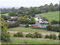
Sun Valley
Dry valley on Clandon Downs with kennels and stabling for local service industries.
Image: © Colin Smith
Taken: 4 Oct 2008
0.12 miles
4

Footpath through beech plantation
Footpath West Clandon 77 through beech plantation heading towards West Clandon crossroads.
Image: © Hugh Craddock
Taken: 25 Feb 2024
0.12 miles
5

Sunray Farm, West Clandon.
Looking up a short dry valley on the dip slope of the North Downs. The clay land hereabouts is much used for "horsieculture", grassland, and only a little cereal cropping. New houses also "crop up" here and there in this wealthy commuter area.
Image: © Colin Smith
Taken: Unknown
0.13 miles
6

Drawing the Line
GBB 1933 for Guildford Borough Boundary? The stone in the background carries 1899, MPB (Merrow Parish Boundary?) and WC (presumably West Clandon).
Image: © Colin Smith
Taken: 1 Jun 2008
0.15 miles
7

Merrow Marker
The stone on the right shows inscriptions 1899 and MPB [Merrow Parish Boundary?]. The reverse carries WC which must be West Clandon. The stone on the left is a Guildford stone, carved with GBB 1933.
Image: © Colin Smith
Taken: 1 Jun 2008
0.16 miles
8

West Clandon - Wild Wood
Avenue carpeted with golden autumnal leaves and lined with white tree trunks in winter sunshine.
Image: © Colin Smith
Taken: 8 Dec 2017
0.19 miles
9

West Clandon - Woodland
Downland avenue through birch trees in the Wild Wood.
Image: © Colin Smith
Taken: 28 Jan 2016
0.19 miles
10

Blooming Daisies
Downland field above West Clandon with a profusion of foot high daisies.
Image: © Colin Smith
Taken: 1 Jun 2008
0.19 miles