
IMAGES TAKEN NEAR TO
Bowers Close, GUILDFORD, GU4 7NE
Introduction
This page details the photographs taken nearby to Bowers Close, GU4 7NE by members of the Geograph project.
The Geograph project started in 2005 with the aim of publishing, organising and preserving representative images for every square kilometre of Great Britain, Ireland and the Isle of Man.

There are currently over 7.5m images from over14,400 individuals and you can help contribute to the project by visiting https://www.geograph.org.uk
Image Map
Images are licensed for reuse under creativecommons.org/licenses/by-sa/2.0
Notes
- Clicking on the map will re-center to the selected point.
- The higher the marker number, the further away the image location is from the centre of the postcode.
Image Listing (52 Images Found)
Images are licensed for reuse under creativecommons.org/licenses/by-sa/2.0
Image
Details
Distance
1
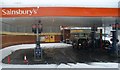
Supertitle, not Subtitle?
Sainsbury's garage at Burpham, Guildford located adjacent to a superstore, is a busy petrol station - except when the snow lies 1 foot deep on the ground!
Image: © Colin Smith
Taken: 2 Feb 2009
0.06 miles
3
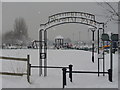
Sutherland Memorial Park
Open grassland in Burpham containing children's playground, football pitches and tennis courts, all under snow and a dark grey sky.
Image: © Colin Smith
Taken: 2 Feb 2009
0.10 miles
4
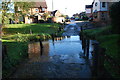
Burpham Ford
This ford is found on Dairyman's Walk at Burpham.
Image: © John Walton
Taken: 10 Nov 2013
0.10 miles
5
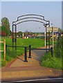
Entrance to Sutherland Memorial Park, Burpham Lane, Burpham, Guildford
One of the entrances to the park. The land was donated by the Duke of Sutherland as a dedicated War Memorial in memory of the residents of Burpham who were killed on active service during the Second World War. Adjoining land was developed and incorporated in the 1990's. The park includes formal gardens, a wildflower meadow, sports and play facilities, a pavilion and a car park.
Image: © P L Chadwick
Taken: 24 May 2012
0.11 miles
6

St. Luke's Church (2) - east end, Burpham Lane, Burpham, Guildford
Image: © P L Chadwick
Taken: 24 May 2012
0.11 miles
7
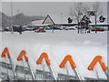
Sainsbury's, Burpham
The large superstore car park is eerily quiet - and covered with a 1 foot deep blanket of snow. The shopping trolleys in the foreground are similarly stacked with snow, not with food.
Image: © Colin Smith
Taken: 2 Feb 2009
0.12 miles
8

Burpham War Memorial (2) - inscription, Burpham Lane, Burpham, Guildford
The inscription on the front gives the names of those who died in the First World War (the Great War). On the reverse are recorded the names of those who died in the Second World War.
Image
Image: © P L Chadwick
Taken: 24 May 2012
0.12 miles
9

Burpham War Memorial (1), Burpham Lane, Burpham, Guildford
The Burpham War Memorial is in the grounds of St. Luke's Church, with access from Burpham Lane. The names on the front relate to those who died in the First World War of 1914-18 (the Great war), and on the reverse are the names of those who died in the Second World War of 1939-45.
Image
Image: © P L Chadwick
Taken: 24 May 2012
0.12 miles
10
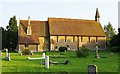
St. Luke's Church (1), Burpham Lane, Burpham, Guildford
Today Burpham is a suburb of Guildford, but originally it was a separate village. St. Luke's Church was consecrated in 1859 as a chapel of ease for Burpham, which at the time was still a village. It didn't become a parish church until about 1954.
Image
Image
Image: © P L Chadwick
Taken: 24 May 2012
0.12 miles