
IMAGES TAKEN NEAR TO
Gosden Hill Road, GUILDFORD, GU4 7JD
Introduction
This page details the photographs taken nearby to Gosden Hill Road, GU4 7JD by members of the Geograph project.
The Geograph project started in 2005 with the aim of publishing, organising and preserving representative images for every square kilometre of Great Britain, Ireland and the Isle of Man.

There are currently over 7.5m images from over14,400 individuals and you can help contribute to the project by visiting https://www.geograph.org.uk
Image Map
Images are licensed for reuse under creativecommons.org/licenses/by-sa/2.0
Notes
- Clicking on the map will re-center to the selected point.
- The higher the marker number, the further away the image location is from the centre of the postcode.
Image Listing (22 Images Found)
Images are licensed for reuse under creativecommons.org/licenses/by-sa/2.0
Image
Details
Distance
1

Gosden Hill Road, Burpham
Absolutely typical post-war council houses.
Image: © David Howard
Taken: 14 Feb 2016
0.01 miles


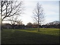
5
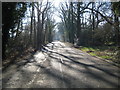
Burpham: Merrow Lane
The 1940s Ordnance Survey map shows this lane as the main road leading into Merrow from the A3. Since then the junction at the A3 has been closed, and the lane now just runs around the east side of the housing estates of Burpham.
Image: © Nigel Cox
Taken: 17 Feb 2008
0.09 miles
6
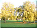
Upfolds Green
Willows on the rectangular open space in residential Burpham.
Image: © Colin Smith
Taken: 2 Nov 2008
0.10 miles
7
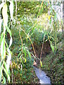
Stream on Merrow Lane
About 1 mile below the spring line on the dip slope of the North Downs, the stream is about 1 foot wide where it passes underneath Merrow Lane in a culvert. Its clay banks, however, are some 2 feet high where it emerges from fields.
Image: © Colin Smith
Taken: 2 Nov 2008
0.11 miles
8

Gosden Hill Road at the junction of Great Oaks Road
Image: © David Howard
Taken: 14 Feb 2016
0.12 miles
9
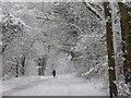
Figure in a Landscape
Merrow Lane. a tree-lined minor road on the eastern edge of Burpham. The snow is about 1 foot deep. The lane was once directly connected to the A3 London-Portsmouth Road.
Image: © Colin Smith
Taken: 2 Feb 2009
0.13 miles
10

Hawthorne Way
Cul-de-sac in residential Burpham. The brick two-storey houses tend to be hidden behind high hedges in this area.
Image: © Colin Smith
Taken: 2 Nov 2008
0.16 miles