IMAGES TAKEN NEAR TO
Harvest Close, YATELEY, GU46 6YS
Introduction
This page details the photographs taken nearby to Harvest Close, GU46 6YS by members of the Geograph project.
The Geograph project started in 2005 with the aim of publishing, organising and preserving representative images for every square kilometre of Great Britain, Ireland and the Isle of Man.

There are currently over 7.5m images from over14,400 individuals and you can help contribute to the project by visiting https://www.geograph.org.uk
Image Map
Images are licensed for reuse under creativecommons.org/licenses/by-sa/2.0
Notes
- Clicking on the map will re-center to the selected point.
- The higher the marker number, the further away the image location is from the centre of the postcode.
Image Listing (12 Images Found)
Images are licensed for reuse under creativecommons.org/licenses/by-sa/2.0
Image
Details
Distance
1
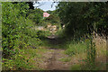
Yateley Common
One of the tracks across the former site of RAF Hartford Bridge, a WWII airfield parts of which have reverted to nature. The southern part of the airfield is given over to general aviation under the name Blackbushe Airfield.
Image: © Alan Hunt
Taken: 18 Jul 2015
0.05 miles
2
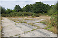
Blackbushe airfield
The entrance to one of the dispersal pans from the perimeter track of this former WWII airfield. The northern part of the airfield has been allowed to revert to nature.
Image: © Alan Hunt
Taken: 18 Jul 2015
0.05 miles
3
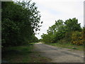
Disused Runway, Blackbushe
Adjoining Blackbushe airport but this part is not used.
Image: © don cload
Taken: 9 May 2009
0.08 miles
4
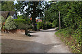
Little Vigo, Yateley
The unmade access road off Vigo Lane on the outskirts of Yateley.
Image: © Alan Hunt
Taken: 18 Jul 2015
0.16 miles
5
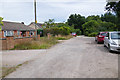
Little Vigo, Yateley
The unmade access road to the houses on the edge of Blackbushe airfield.
Image: © Alan Hunt
Taken: 18 Jul 2015
0.16 miles
6
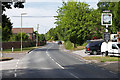
Vigo Lane, Yateley
Vigo Lane entering Yateley passing the Anchor public house on the right.
Image: © Alan Hunt
Taken: 18 Jul 2015
0.17 miles
7
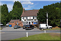
The Anchor, Yateley
The Anchor Inn on Vigo Lane on the outskirts of Yateley.
Image: © Alan Hunt
Taken: 18 Jul 2015
0.18 miles
8
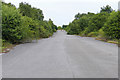
Blackbushe airfield perimeter track
A section of the old perimeter track still in very good condition of the former RAF Hartford Bridge, a WWII airfield.
Image: © Alan Hunt
Taken: 18 Jul 2015
0.18 miles
9
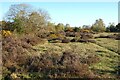
Heathland, Yateley
The northern part of Blackbushe Airport reverting to nature.
Image: © Andrew Smith
Taken: 22 Apr 2021
0.19 miles