IMAGES TAKEN NEAR TO
Hearmon Close, YATELEY, GU46 6XD
Introduction
This page details the photographs taken nearby to Hearmon Close, GU46 6XD by members of the Geograph project.
The Geograph project started in 2005 with the aim of publishing, organising and preserving representative images for every square kilometre of Great Britain, Ireland and the Isle of Man.

There are currently over 7.5m images from over14,400 individuals and you can help contribute to the project by visiting https://www.geograph.org.uk
Image Map
Images are licensed for reuse under creativecommons.org/licenses/by-sa/2.0
Notes
- Clicking on the map will re-center to the selected point.
- The higher the marker number, the further away the image location is from the centre of the postcode.
Image Listing (31 Images Found)
Images are licensed for reuse under creativecommons.org/licenses/by-sa/2.0
Image
Details
Distance
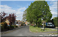
1
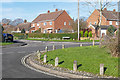
Somerville Crescent, Yateley
Looking across Somerville Crescent to the junction with Hearmon Close.
Image: © Alan Hunt
Taken: 11 Feb 2016
0.04 miles
2
Somerville Crescent, yateley
The junction between Somerville Crescent and Manor Park Drive on the right.
Image: © Alan Hunt
Taken: 11 Feb 2016
0.04 miles
3
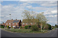
Somerville Crescent and Manor Park Drive
Suburban residential streets.
Image: © Des Blenkinsopp
Taken: 26 Apr 2022
0.05 miles
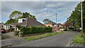
4
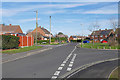
Manor Park Drive, Yateley
Manor Park Drive in the housing estate to the south of the town centre.
Image: © Alan Hunt
Taken: 11 Feb 2016
0.10 miles
5
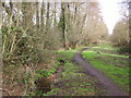
Royal Oak Valley stream and footpath
The Royal Oak valley is a linear nature reserve. It contains a stream fed from Yateley Common which winds its way down the valley, under the main road in Yateley and eventually into the River Blackwater. The area is also used as a drainage area in heavy storms. It is an area of wet willow woodland, alder carr and wet meadow.
Image: © Diane Sambrook
Taken: 27 Feb 2008
0.12 miles
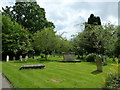
7
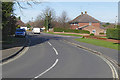
Manor Park Drive, Yateley
The junction between Manor Park Drive and Somerville Crescent. The road joins the Reading Road just round the bend to the right.
Image: © Alan Hunt
Taken: 11 Feb 2016
0.19 miles
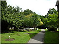
10
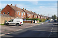
Rosary Gardens, Yateley
A cul de sac of houses around a small central green.
Image: © Des Blenkinsopp
Taken: 26 Apr 2022
0.22 miles