IMAGES TAKEN NEAR TO
Downsview Road, BORDON, GU35 8JH
Introduction
This page details the photographs taken nearby to Downsview Road, GU35 8JH by members of the Geograph project.
The Geograph project started in 2005 with the aim of publishing, organising and preserving representative images for every square kilometre of Great Britain, Ireland and the Isle of Man.

There are currently over 7.5m images from over14,400 individuals and you can help contribute to the project by visiting https://www.geograph.org.uk
Image Map
Images are licensed for reuse under creativecommons.org/licenses/by-sa/2.0
Notes
- Clicking on the map will re-center to the selected point.
- The higher the marker number, the further away the image location is from the centre of the postcode.
Image Listing (9 Images Found)
Images are licensed for reuse under creativecommons.org/licenses/by-sa/2.0
Image
Details
Distance
2
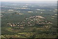
Maple Way
Housing estate in Headley Down.
Image: © Ben Gamble
Taken: 22 Jul 2005
0.14 miles
3

The Village Store
Now a private dwelling, this was from C1900 till c1970 Wilsons Shop. It housed the Headley Down post office and the road it stands on, now called "Wilsons Road" was originally "Post Office Road".
Image: © George R
Taken: 17 May 2004
0.14 miles

5
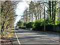
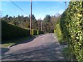
Grayshott Road, Headley Down
The B3002 towards Grayshott and Hindhead.
Image: © Robin Webster
Taken: 28 Jan 2016
0.19 miles
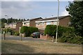
6
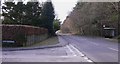
Bus stops on Grayshott Road
These serve the residents of Headley Down.
Image: © Shazz
Taken: 11 Feb 2010
0.19 miles
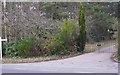
7
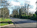
Grayshott Road, Headley Down
The B3002 towards Grayshott and Hindhead.
Image: © Robin Webster
Taken: 28 Jan 2016
0.20 miles