IMAGES TAKEN NEAR TO
Frith End, BORDON, GU35 0QS
Introduction
This page details the photographs taken nearby to Frith End, GU35 0QS by members of the Geograph project.
The Geograph project started in 2005 with the aim of publishing, organising and preserving representative images for every square kilometre of Great Britain, Ireland and the Isle of Man.

There are currently over 7.5m images from over14,400 individuals and you can help contribute to the project by visiting https://www.geograph.org.uk
Image Map
Images are licensed for reuse under creativecommons.org/licenses/by-sa/2.0
Notes
- Clicking on the map will re-center to the selected point.
- The higher the marker number, the further away the image location is from the centre of the postcode.
Image Listing (11 Images Found)
Images are licensed for reuse under creativecommons.org/licenses/by-sa/2.0
Image
Details
Distance
1
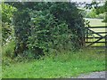
Overgrown footpath near Abbotts Wood
The barely discernible path is at the left of the picture.
Image: © Shazz
Taken: 27 Jul 2009
0.08 miles
2
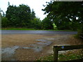
Shipwrights' Way 16
A road is reached at Frith End.
Image: © Shazz
Taken: 11 Oct 2013
0.11 miles
3
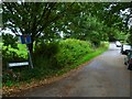
Shipwrights' Way 17
This is the north end of Cradle Lane and the way is ahead.
Image: © Shazz
Taken: 11 Oct 2013
0.12 miles
4
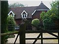
"Kites" on Cradle Lane
Cradle Lane is a byway which is closed to all users except pedestrians!
Image: © Shazz
Taken: 27 Jul 2009
0.12 miles
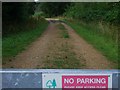
6
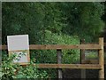
Cradle Lane
Beyond the few houses Cradle Lane, which is mapped as a byway, is declared to be closed to all users except pedestrians! Unfortunately the wording of the notice is not discernible in this picture. There is some problem with the river crossing in half a mile.
Image: © Shazz
Taken: 27 Jul 2009
0.15 miles
7
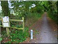
Shipwrights' Way 18
Cradle Lane becomes a byway. The last time I was here though only pedestrians could use it - see http://www.geograph.org.uk/photo/1417298.
Image: © Shazz
Taken: 11 Oct 2013
0.15 miles
8
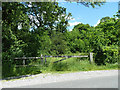
Barrier at a woodland entrance
The wood, Abbotts Wood Inclosure, actually has public access as part of the Forestry Commission Alice Holt Forest, but the preferred way in is elsewhere.
Image: © Robin Webster
Taken: 8 Jun 2014
0.18 miles