IMAGES TAKEN NEAR TO
Reads Field, ALTON, GU34 5XA
Introduction
This page details the photographs taken nearby to Reads Field, GU34 5XA by members of the Geograph project.
The Geograph project started in 2005 with the aim of publishing, organising and preserving representative images for every square kilometre of Great Britain, Ireland and the Isle of Man.

There are currently over 7.5m images from over14,400 individuals and you can help contribute to the project by visiting https://www.geograph.org.uk
Image Map
Images are licensed for reuse under creativecommons.org/licenses/by-sa/2.0
Notes
- Clicking on the map will re-center to the selected point.
- The higher the marker number, the further away the image location is from the centre of the postcode.
Image Listing (20 Images Found)
Images are licensed for reuse under creativecommons.org/licenses/by-sa/2.0
Image
Details
Distance
1
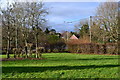
Landscaping between A31 Winchester Road and modern housing
Image: © David Martin
Taken: 9 Jan 2014
0.10 miles
2
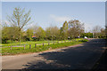
Lymington Bottom approaching Winchester Road
With a grassy open space on the left.
Image: © Peter Facey
Taken: 19 Apr 2009
0.12 miles
3

Staggered Crossroads on A31 at Four Marks
Lymington Bottom Road here crosses the A31 Winchester Road in a dip which will be familiar to anyone who drives this routes.
Image: © Peter Facey
Taken: 19 Apr 2009
0.12 miles
4

Path beside Lymington Bottom
Lymington Bottom Road crosses the A31 in a staggered crossroads behind photographer. I think it likely that the road originally crossed directly and that this path used to be the road.
Image: © Peter Facey
Taken: 19 Apr 2009
0.13 miles
5
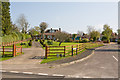
Lymington Close
Seen from Lymington Bottom Road. The house on the left is number 10.
Image: © Peter Facey
Taken: 19 Apr 2009
0.15 miles
6
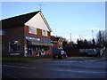
Four Marks Hardware Store
There seems to be a common trend in Hampshire to put hardware stores in small villages. See Image This one has just about everything you need.
Image: © Graham Clutton
Taken: 31 Dec 2005
0.15 miles
7
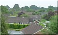
Four Marks from the Mid Hants Railway
Looking south to bungalows in Churchill Close and Winston Rise. Given the street names and the architecture, probably built in the mid 1960s.
Image: © Christine Johnstone
Taken: 4 Jun 2016
0.17 miles