
IMAGES TAKEN NEAR TO
Lymington Bottom Road, ALTON, GU34 5FR
Introduction
This page details the photographs taken nearby to Lymington Bottom Road, GU34 5FR by members of the Geograph project.
The Geograph project started in 2005 with the aim of publishing, organising and preserving representative images for every square kilometre of Great Britain, Ireland and the Isle of Man.

There are currently over 7.5m images from over14,400 individuals and you can help contribute to the project by visiting https://www.geograph.org.uk
Image Map
Images are licensed for reuse under creativecommons.org/licenses/by-sa/2.0
Notes
- Clicking on the map will re-center to the selected point.
- The higher the marker number, the further away the image location is from the centre of the postcode.
Image Listing (18 Images Found)
Images are licensed for reuse under creativecommons.org/licenses/by-sa/2.0
Image
Details
Distance
1
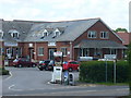
Lymington Barn Industrial Estate
Small and modern commercial area on Lymington Bottom Road, Medstead.
http://www.medstead.org/
Image: © Colin Smith
Taken: 21 May 2011
0.03 miles
2
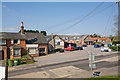
Mansfield Business Park, Lymington Bottom Road
With Clementines fruit and veg store at left. Viewed from a mound.
Image: © Peter Facey
Taken: 19 Apr 2009
0.03 miles
3
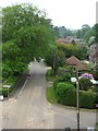
Cyclist heading north on Lymington Bottom Road
Seen from a train on the Mid-Hants Railway, west of the station at Four Marks.
Image: © Christine Johnstone
Taken: 4 Jun 2016
0.06 miles
4
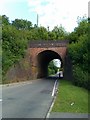
Railway bridge over Lymington Bottom Road
Image: © David Martin
Taken: 10 Jul 2011
0.09 miles
5
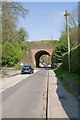
Lymington Bottom Road
Passes under embanked railway line.
Image: © Peter Facey
Taken: 19 Apr 2009
0.09 miles
6
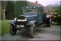
Old Ford Lorry!
This lorry is a 1933 Model AAF, flat-bed truck. It was once used by the London & North Eastern Railway to transfer passenger luggage from Liverpool Street to the large hotels in London. Restored to working order by a group of railway enthusiasts, it appeared at many open days and rallies before returning to the care of the Science Museum for safe keeping.
Image: © Clive Warneford
Taken: Unknown
0.10 miles
7
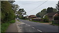
Leaving Four Marks
The road heading north west from Four Marks.
Image: © Peter Mackenzie
Taken: 23 Apr 2019
0.12 miles
8
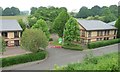
Units at Mansfield Business Park, Four Marks
On the north side of Station Approach and the embanked railway line. There are eight high-spec office units in this phased development, to rent or buy.
Image: © Christine Johnstone
Taken: 4 Jun 2016
0.15 miles
9
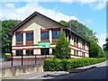
Mansfield Business Park, Medstead
Modern industrial estate, on Station Approach close to the A31 Alton-Winchester Road, and with space for new owners or occupiers.
http://www.medstead.org/
Image: © Colin Smith
Taken: 21 May 2011
0.16 miles
10
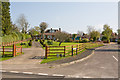
Lymington Close
Seen from Lymington Bottom Road. The house on the left is number 10.
Image: © Peter Facey
Taken: 19 Apr 2009
0.18 miles