
IMAGES TAKEN NEAR TO
Upper Neatham Mill Lane, ALTON, GU34 4EP
Introduction
This page details the photographs taken nearby to Upper Neatham Mill Lane, GU34 4EP by members of the Geograph project.
The Geograph project started in 2005 with the aim of publishing, organising and preserving representative images for every square kilometre of Great Britain, Ireland and the Isle of Man.

There are currently over 7.5m images from over14,400 individuals and you can help contribute to the project by visiting https://www.geograph.org.uk
Image Map
Images are licensed for reuse under creativecommons.org/licenses/by-sa/2.0
Notes
- Clicking on the map will re-center to the selected point.
- The higher the marker number, the further away the image location is from the centre of the postcode.
Image Listing (11 Images Found)
Images are licensed for reuse under creativecommons.org/licenses/by-sa/2.0
Image
Details
Distance
1
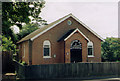
Holybourne Kingdom Hall
Originally built for the Presbyterians in 1864 then later becoming a Gospel Hall. It is now with the Jehovah's Witnesses.
Image: © Michael FORD
Taken: Unknown
0.07 miles
2
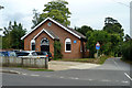
Kingdom Hall of Jehovah's Witnesses
The Alton congregation meet here.
Image: © Robin Webster
Taken: 18 Jul 2015
0.07 miles
3
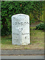
Turnpike milestone, Holybourne
A milestone on the Bagshot - Alton section of the turnpike to Winchester, opened in the mid-eighteenth century. This was formerly the main road before Alton was bypassed in the 20th century.
Image: © Robin Webster
Taken: 18 Jul 2015
0.08 miles
4
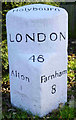
Old Milestone by London Road, Holybourne
Carved stone post by the UC road (was A31), in parish of ALTON (EAST HAMPSHIRE District), Lord Mayor Treloar College, by the road, on South side of road. Hartford limestone diamond, erected by the Winchester, Upper District (Bagshot to Farnham) turnpike trust in the 19th century.
Inscription reads:-
: Alton / 1 : : Holybourn : : LONDON / 46 : : Farnham / 8 :
Grade II listed.
List Entry Number: 1179858 https://historicengland.org.uk/listing/the-list/list-entry/1179858
Milestone Society National ID: HA_FAAL08.
Image: © K Lawrence
Taken: 31 Dec 2002
0.09 miles
6
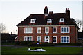
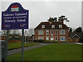
Andrews' Endowed Church of England Primary School, Holybourne, Hampshire
The school is over 200 years old.
http://www.andrewsendowedschool.com/
Image: © Peter Trimming
Taken: 2 Jan 2010
0.09 miles
7
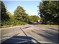
Mill Lane at the junction of Montecchio Way
It's all very well naming roads after foreign cities but how many people will actually spell them properly?
Image: © David Howard
Taken: 14 Aug 2016
0.14 miles

9
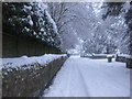
Howards Lane, Holybourne
2010 January Snow
Image: © Lynn Croucher
Taken: 6 Jan 2010
0.22 miles
10
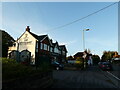
Making use of that extra hour (29)
Pub in London Road
Image: © Basher Eyre
Taken: 1 Nov 2021
0.24 miles