
IMAGES TAKEN NEAR TO
Wivelrod Road, ALTON, GU34 4AR
Introduction
This page details the photographs taken nearby to Wivelrod Road, GU34 4AR by members of the Geograph project.
The Geograph project started in 2005 with the aim of publishing, organising and preserving representative images for every square kilometre of Great Britain, Ireland and the Isle of Man.

There are currently over 7.5m images from over14,400 individuals and you can help contribute to the project by visiting https://www.geograph.org.uk
Image Map
Images are licensed for reuse under creativecommons.org/licenses/by-sa/2.0
Notes
- Clicking on the map will re-center to the selected point.
- The higher the marker number, the further away the image location is from the centre of the postcode.
Image Listing (7 Images Found)
Images are licensed for reuse under creativecommons.org/licenses/by-sa/2.0
Image
Details
Distance

2
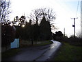
A lane at Wivelrod
Wivelrod was a small farming community. Now the houses serve the upper end of the market. A car is essential as the village is remote with no facilities.
Image: © Graham Clutton
Taken: 31 Dec 2005
0.10 miles
4
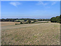
Farmland, Bentworth
Arable fields to the west of the hamlet of Wivelrod.
Image: © Andrew Smith
Taken: 27 Sep 2009
0.16 miles
5

Footpath to Wivelrod
View east from public footpath Bentworth 19, towards Wivelrod. The footpath continues along the green lane which can be seen to the right of the cultivated field.
Image: © Hugh Craddock
Taken: 13 Oct 2012
0.16 miles
6
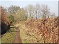
Tinker's Lane, Wivelrod
Old hedgerow-lined lane running north from Wivelrod towards Bentworth. The lane is now a byway and has fortunately not suffered much damage from wheeled vehicles.
Image: © Colin Smith
Taken: 1 Feb 2012
0.20 miles
7
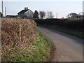
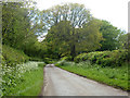
Wivelrod Road
Hedgerow-lined country lane crossing downland west of Alton.
Image: © Colin Smith
Taken: 1 Feb 2012
0.24 miles