IMAGES TAKEN NEAR TO
Basingstoke Road, ALTON, GU34 4AB
Introduction
This page details the photographs taken nearby to Basingstoke Road, GU34 4AB by members of the Geograph project.
The Geograph project started in 2005 with the aim of publishing, organising and preserving representative images for every square kilometre of Great Britain, Ireland and the Isle of Man.

There are currently over 7.5m images from over14,400 individuals and you can help contribute to the project by visiting https://www.geograph.org.uk
Image Map
Images are licensed for reuse under creativecommons.org/licenses/by-sa/2.0
Notes
- Clicking on the map will re-center to the selected point.
- The higher the marker number, the further away the image location is from the centre of the postcode.
Image Listing (11 Images Found)
Images are licensed for reuse under creativecommons.org/licenses/by-sa/2.0
Image
Details
Distance
1
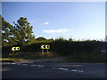
Basingstoke Road at the junction of Medstead Road
Image: © David Howard
Taken: 14 Aug 2016
0.02 miles
3
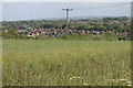
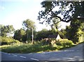
Alton, Hampshire
Looking across farmland from the minor road in the southwest of the square.
Image: © Brendan and Ruth McCartney
Taken: 22 May 2011
0.10 miles

5
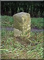
Old Milestone by the A339, Basingstoke Road, west of Alton
Metal plate attached to stone post by the A339, in parish of ALTON (EAST HAMPSHIRE District), South of Keeper's Lodge, by the road, on North side of road. Candover block, erected by the Basingstoke, Preston Candover & Alton turnpike trust in the 19th century.
Inscription reads:-
: ALTON / 1 : : B'STOKE / 10 :
Grade II listed.
List Entry Number: 1391749 https://historicengland.org.uk/listing/the-list/list-entry/1391749
Milestone Society National ID: HA_BAAL10.
Image: © K Lawrence
Taken: 31 Dec 2002
0.15 miles
6
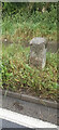
Old Milestone by the A339, Basingstoke Road, west of Alton
Metal plate attached to stone post by the A339, in parish of ALTON (EAST HAMPSHIRE District), South of Keeper's Lodge, by the road, on North side of road. Candover block, erected by the Basingstoke, Preston Candover & Alton turnpike trust in the 19th century.
Inscription reads:-
: ALTON / 1 : : B'STOKE / 10 :
Grade II listed.
List Entry Number: 1391749 https://historicengland.org.uk/listing/the-list/list-entry/1391749
Milestone Society National ID: HA_BAAL10.
Image: © Jo Murray
Taken: 20 Sep 2023
0.15 miles
7
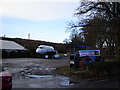
Cafe! at Valley Nursery, Alton
This old aircraft is in use as a cafe, you can have your coffee in the original pilot's seat complete with control column. Afterwards buy your plants at the nursery.
Image: © Graham Clutton
Taken: 31 Dec 2005
0.17 miles
8
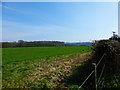
Looking across large field by Snode Hill to edge of woodland
Alton is in the far distance.
Image: © Shazz
Taken: 29 Mar 2014
0.18 miles