
IMAGES TAKEN NEAR TO
Gosport Road, ALTON, GU34 3DQ
Introduction
This page details the photographs taken nearby to Gosport Road, GU34 3DQ by members of the Geograph project.
The Geograph project started in 2005 with the aim of publishing, organising and preserving representative images for every square kilometre of Great Britain, Ireland and the Isle of Man.

There are currently over 7.5m images from over14,400 individuals and you can help contribute to the project by visiting https://www.geograph.org.uk
Image Map
Images are licensed for reuse under creativecommons.org/licenses/by-sa/2.0
Notes
- Clicking on the map will re-center to the selected point.
- The higher the marker number, the further away the image location is from the centre of the postcode.
Image Listing (20 Images Found)
Images are licensed for reuse under creativecommons.org/licenses/by-sa/2.0
Image
Details
Distance

2

Rape Field
Field of rape awaiting harvesting near Southfield Farm.
Image: © Ben Gamble
Taken: 14 Aug 2005
0.12 miles
3

Trackbed of the Meon Valley Railway, Chawton, Hampshire
Looking towards the south. Next stop along this line would have been the halt at Farringdon.
http://en.wikipedia.org/wiki/Meon_Valley_Railway
Image: © Peter Trimming
Taken: 25 Jul 2009
0.13 miles


6

Landscape Evolution, Chawton, Hampshire
A useful picture, demonstrating how the landscape, and land usage, might have evolved since the end of the 19th century.
The green path, complete with wild flowers, is as wide as it appears in the photograph. The right-hand field follows a continuous line along the path, and continues to the right of the line of trees in the distance. The green path continues until it meets the line of trees, turns left for a few yards, turns right and dives between two rows of trees. At this point, the path is on the trackbed of the Meon Valley Railway.
http://en.wikipedia.org/wiki/Meon_Valley_Railway
This means that the green path was once the bank at the right side of the railway line, and it is likely that a row of trees formed a boundary, here, with the right-hand field. Certainly the farmer, who owned the left-hand field, bought additional land after the railway closed in 1968, and extended his field across the trackbed. This would have required some landscaping, and probably re-set the landscape to something approaching the 19th century appearance. It would be interesting to see whether older photographs exist for this location.
Image: © Peter Trimming
Taken: 25 Jul 2009
0.15 miles
7
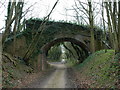
Bridge over dismantled railway
The old Meon Valley line is now just a footpath, but some bridges are still in place. Beyond this one the trees can be seen making a natural tunnel.
Image: © Aidan Simons
Taken: 24 Mar 2008
0.15 miles


10

Stile by Gosport Road
Stile and footpath which parallels the main road leading south from Chawton.
http://www.chawton.info/
Image: © Colin Smith
Taken: 24 Feb 2012
0.16 miles