
IMAGES TAKEN NEAR TO
Ashdell Road, ALTON, GU34 2TB
Introduction
This page details the photographs taken nearby to Ashdell Road, GU34 2TB by members of the Geograph project.
The Geograph project started in 2005 with the aim of publishing, organising and preserving representative images for every square kilometre of Great Britain, Ireland and the Isle of Man.

There are currently over 7.5m images from over14,400 individuals and you can help contribute to the project by visiting https://www.geograph.org.uk
Image Map
Images are licensed for reuse under creativecommons.org/licenses/by-sa/2.0
Notes
- Clicking on the map will re-center to the selected point.
- The higher the marker number, the further away the image location is from the centre of the postcode.
Image Listing (222 Images Found)
Images are licensed for reuse under creativecommons.org/licenses/by-sa/2.0
Image
Details
Distance
1
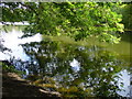
King's Pond
Today, a shady pond in a wooded park in Alton but it was created by a William King who had a water mill built here on the River Wey.
Image: © Colin Smith
Taken: 3 Sep 2011
0.06 miles
2
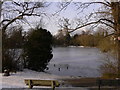
Frozen lake at Alton
The ducks are assembling to have some of my oat bar. Above the houses in the background are the plumes of smoke from a steam train on the Watercress Line which is on its way west to Alresford.
Image: © Shazz
Taken: 26 Dec 2010
0.07 miles
4
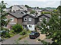
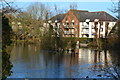
Houses in Russet Road, Alton
Taken through the open window of a westbound train on the Mid Hants Railway.
Image: © Christine Johnstone
Taken: 24 Jun 2014
0.10 miles
5
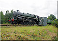
Watercress Line, Alton
73096 about to cross Paper Mill Lane bridge, seen from the footpath alongside the railway.
Image: © Pierre Terre
Taken: 29 Aug 2008
0.11 miles
6
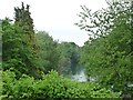
King's Pond, Alton [northern end]
The pond is fed by the River Wey. It was probably created by William King in the late 1700s. He made paper at a local mill. The area is now a public open space, maintained by the town council.
Image: © Christine Johnstone
Taken: 4 Jun 2016
0.12 miles
7
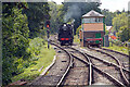
'Cheltenham' running round at Alton
The locomotive is adjacent to the Watercress Line signal box, built after the heritage line was reconnected to Alton.
Image: © John Lucas
Taken: 7 Sep 2022
0.12 miles
9
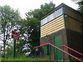
Signal Box, Alton
On the Watercress Line close to Alton Station. The sign has had initials "redded out" from L&SER to SR for Southern Railway. The box is in cream and green SR livery.
www.watercressline.co.uk
Image: © Colin Smith
Taken: 28 May 2011
0.13 miles
10
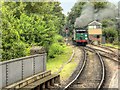
The Watercress Line, Signal Box at Alton
Ex-British Rail Southern Region steam locomotive number 850 "Lord Nelson" passes the signal box at Alton as it runs round its train ready for the return journey to Alresford on the Mid-Hants Railway. This signal box is the only one on the MHR that is not located on a platform and it therefore has a higher ‘locking room’ structure http://www.watercressline.co.uk/article.php/640/alton-signal-box .
Image: © David Dixon
Taken: 19 Jul 2014
0.13 miles