
IMAGES TAKEN NEAR TO
Dashwood Close, ALTON, GU34 1RS
Introduction
This page details the photographs taken nearby to Dashwood Close, GU34 1RS by members of the Geograph project.
The Geograph project started in 2005 with the aim of publishing, organising and preserving representative images for every square kilometre of Great Britain, Ireland and the Isle of Man.

There are currently over 7.5m images from over14,400 individuals and you can help contribute to the project by visiting https://www.geograph.org.uk
Image Map
Images are licensed for reuse under creativecommons.org/licenses/by-sa/2.0
Notes
- Clicking on the map will re-center to the selected point.
- The higher the marker number, the further away the image location is from the centre of the postcode.
Image Listing (43 Images Found)
Images are licensed for reuse under creativecommons.org/licenses/by-sa/2.0
Image
Details
Distance
1
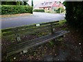
The southern end of Kings Road with memorial seat in foreground
Image: © Shazz
Taken: 16 Aug 2014
0.14 miles
2
Spring forward, fall back (73)
Looking from Highridge into Kings Road
Image: © Basher Eyre
Taken: 28 Mar 2022
0.15 miles
3
Spring forward, fall back (72)
Lamppost in Kings Road
Image: © Basher Eyre
Taken: 28 Mar 2022
0.15 miles
4
Spring forward, fall back (74)
Seat in Highridge, looking across to Pertuis Avenue
Image: © Basher Eyre
Taken: 28 Mar 2022
0.16 miles
5
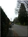
Spring forward, fall back (71)
Looking south-west along Kings Road
Image: © Basher Eyre
Taken: 28 Mar 2022
0.17 miles
6
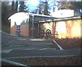
Chawton Park Surgery
This is built on the site of the coal siding for Lord Mayor Treloar's Hospital. A once famous Orthopaedic hospital now closed and demolished.
Image: © Graham Clutton
Taken: 25 Dec 2005
0.17 miles
7
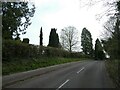
Spring forward, fall back (75)
Looking south-east in Highridge
Image: © Basher Eyre
Taken: 28 Mar 2022
0.17 miles
9
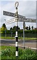
Direction Sign - Signpost by the A339, Whitedown Lane, The Butts
Annulus finial - 4 arms; Hampshire Parish halo by the A339, in parish of Alton (East Hampshire District), at The Butts, on a grass triangle on the west side of the junction of the A339 Whitedown Lane and Chawton Park Road. The A339; SELBORNE 4 / LISS 8 arm was broken off some time after May 2022.
Surveyed
Milestone Society National ID: HA_SU7138
Image: © Milestone Society
Taken: 1 Jan 2015
0.17 miles
10
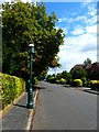
Looking north east on Kings Road
According to the note on the gas lamp it is temporarily out of action. The lamp is Grade II listed - see http://www.britishlistedbuildings.co.uk/en-476968-gas-lamp-standard-outside-number-52-alto.
Image: © Shazz
Taken: 16 Aug 2014
0.17 miles