IMAGES TAKEN NEAR TO
Mount Pleasant Road, ALTON, GU34 1NH
Introduction
This page details the photographs taken nearby to Mount Pleasant Road, GU34 1NH by members of the Geograph project.
The Geograph project started in 2005 with the aim of publishing, organising and preserving representative images for every square kilometre of Great Britain, Ireland and the Isle of Man.

There are currently over 7.5m images from over14,400 individuals and you can help contribute to the project by visiting https://www.geograph.org.uk
Image Map
Images are licensed for reuse under creativecommons.org/licenses/by-sa/2.0
Notes
- Clicking on the map will re-center to the selected point.
- The higher the marker number, the further away the image location is from the centre of the postcode.
Image Listing (238 Images Found)
Images are licensed for reuse under creativecommons.org/licenses/by-sa/2.0
Image
Details
Distance

2
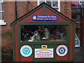
The Ivy House on Draymans Way, Alton
This is the new extension to the Victorian pub on the right
Image: © David Howard
Taken: 14 Aug 2016
0.05 miles


6

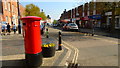
Road Junction, Alton
Butts road meets the High Street and Draymans Way
Image: © Chris Gunns
Taken: 12 Aug 2009
0.08 miles