IMAGES TAKEN NEAR TO
Whitedown, ALTON, GU34 1LS
Introduction
This page details the photographs taken nearby to Whitedown, GU34 1LS by members of the Geograph project.
The Geograph project started in 2005 with the aim of publishing, organising and preserving representative images for every square kilometre of Great Britain, Ireland and the Isle of Man.

There are currently over 7.5m images from over14,400 individuals and you can help contribute to the project by visiting https://www.geograph.org.uk
Image Map (Loading...)


Getting Data...Please wait
Leaflet Map data © OpenStreetMap
Images are licensed for reuse under creativecommons.org/licenses/by-sa/2.0
Notes
- Clicking on the map will re-center to the selected point.
- The higher the marker number, the further away the image location is from the centre of the postcode.
Image Listing (139 Images Found)
Images are licensed for reuse under creativecommons.org/licenses/by-sa/2.0
Image
Details
Distance
2
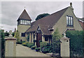
Alton Former St Mary Roman Catholic Church
Erected in 1911. Now converted into a private residence.
Image: © Michael FORD
Taken: Unknown
0.04 miles
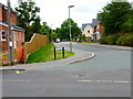
7

Miss Bell's Fountain: Spring 2018
Also see http://www.alton.gov.uk/Miss_Bells_Fountain_6322.aspx
Image: © Basher Eyre
Taken: 22 Apr 2018
0.08 miles
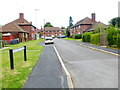
8

Looking from Butts Road into Albert Road
Image: © Basher Eyre
Taken: 22 Apr 2018
0.08 miles
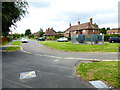
10
Looking from Butts Road into Borovere Gardens
Image: © Basher Eyre
Taken: 22 Apr 2018
0.09 miles