IMAGES TAKEN NEAR TO
Reed Way, PETERSFIELD, GU32 3FL
Introduction
This page details the photographs taken nearby to Reed Way, GU32 3FL by members of the Geograph project.
The Geograph project started in 2005 with the aim of publishing, organising and preserving representative images for every square kilometre of Great Britain, Ireland and the Isle of Man.

There are currently over 7.5m images from over14,400 individuals and you can help contribute to the project by visiting https://www.geograph.org.uk
Image Map
Images are licensed for reuse under creativecommons.org/licenses/by-sa/2.0
Notes
- Clicking on the map will re-center to the selected point.
- The higher the marker number, the further away the image location is from the centre of the postcode.
Image Listing (112 Images Found)
Images are licensed for reuse under creativecommons.org/licenses/by-sa/2.0
Image
Details
Distance
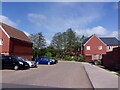
1
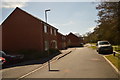
New houses on Reed Way
The houses on this part of the estate were all built in the last 5 years.
Image: © Martyn Pattison
Taken: 4 Apr 2020
0.02 miles
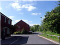
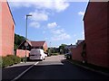
6
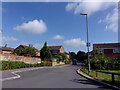
A sunny spring morning in Larcombe Road
Image: © Basher Eyre
Taken: 14 May 2022
0.04 miles
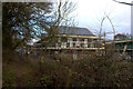
9
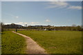
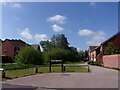
Children's playground and Football field
Image: © Martyn Pattison
Taken: 4 Apr 2020
0.05 miles
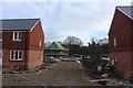
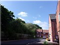
10
Looking from Larcombe Road into Marsh Close
Image: © Basher Eyre
Taken: 14 May 2022
0.07 miles