
IMAGES TAKEN NEAR TO
Station Road, PETERSFIELD, GU32 3ET
Introduction
This page details the photographs taken nearby to Station Road, GU32 3ET by members of the Geograph project.
The Geograph project started in 2005 with the aim of publishing, organising and preserving representative images for every square kilometre of Great Britain, Ireland and the Isle of Man.

There are currently over 7.5m images from over14,400 individuals and you can help contribute to the project by visiting https://www.geograph.org.uk
Image Map
Images are licensed for reuse under creativecommons.org/licenses/by-sa/2.0
Notes
- Clicking on the map will re-center to the selected point.
- The higher the marker number, the further away the image location is from the centre of the postcode.
Image Listing (846 Images Found)
Images are licensed for reuse under creativecommons.org/licenses/by-sa/2.0
Image
Details
Distance
1
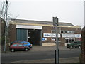
Former Southdown Bus Garage
How we all miss the cream and lime green livery.
Image: © Basher Eyre
Taken: 20 Feb 2008
0.01 miles
2
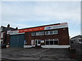
Petersfield means business (3)
This used to be the Southdown Bus Depot. The house left of shot belonged to a friend of mine Gertie Caplen, RIP
For more about Southdown see https://en.wikipedia.org/wiki/Southdown_Motor_Services
Image: © Basher Eyre
Taken: 27 Oct 2019
0.01 miles
3
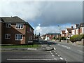
114: Going through a tightwind (clockwise)
Junction of King George Avenue and Station Road
Image: © Basher Eyre
Taken: 12 Mar 2022
0.02 miles
4
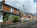
113: Going through a tightwind (clockwise)
Top end of King George Avenue
The house with the three bushes in front of it belonged to a very dear friend of mine, Renee Thomson (RIP)
Image: © Basher Eyre
Taken: 12 Mar 2022
0.02 miles
5
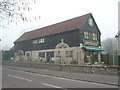
Victoriana
Not as interesting as it sounds, I felt.
Image: © Basher Eyre
Taken: 20 Feb 2008
0.03 miles
6
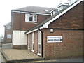
Gloucester Court
Built on the home of Mr and Mrs Rodgers, shopkeepers extrordinaire.
Image: © Basher Eyre
Taken: 20 Feb 2008
0.04 miles
7
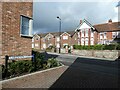
116: Going through a tightwind (clockwise)
Junction of Clarendon Close and Station Road
Image: © Basher Eyre
Taken: 12 Mar 2022
0.04 miles
8
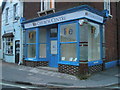
Yet another incarnation for "Rodgers"
Taken in Station Road- see also http://www.geograph.org.uk/photo/699513 and http://www.geograph.org.uk/photo/1182136
Image: © Basher Eyre
Taken: 20 Jul 2010
0.04 miles
9
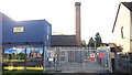
Old Pump House Chimney
At the time of photography the site was being redeveloped as Clarendon Close. The development consists of seven new homes, including Petersfield's first two 'passive houses'. Two office work spaces are also planned, situated in the two surviving buildings that are being retained and refurbished. The first of these is the old pump house (pictured) with its distinctive chimney. The other old building was a large old barn (probably 18th century) but I believe that structural issues have been encountered and its future is uncertain. Prior to the redevelopment the site was occupied by a motley collection of buildings occupied by various local businesses. In the 1970s and 1980s the main ones were a carpentry business in the barn, a plant hire business in the pump house and a local garage, Collins & White (52c College Street), founded about 1969. The site was latterly called Holder's Yard (after the owning family) and until about the early 1990s had two entrances - one pictured and a bigger one through what is now a residential property at the end of College Street.
Image: © Paul Collins
Taken: 5 Nov 2017
0.04 miles
10
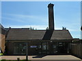
Offices in old pump house
This old industrial building has been recently re-opened as an Architect's office.
Image: © Martyn Pattison
Taken: 8 May 2020
0.04 miles