
IMAGES TAKEN NEAR TO
Chapel Street, PETERSFIELD, GU32 3DZ
Introduction
This page details the photographs taken nearby to Chapel Street, GU32 3DZ by members of the Geograph project.
The Geograph project started in 2005 with the aim of publishing, organising and preserving representative images for every square kilometre of Great Britain, Ireland and the Isle of Man.

There are currently over 7.5m images from over14,400 individuals and you can help contribute to the project by visiting https://www.geograph.org.uk
Image Map
Images are licensed for reuse under creativecommons.org/licenses/by-sa/2.0
Notes
- Clicking on the map will re-center to the selected point.
- The higher the marker number, the further away the image location is from the centre of the postcode.
Image Listing (1631 Images Found)
Images are licensed for reuse under creativecommons.org/licenses/by-sa/2.0
Image
Details
Distance
1
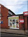
Petersfield means business (71)
Sunshine Health, Therapeutic Massage
(Lavant Street)
Image: © Basher Eyre
Taken: 27 Oct 2019
0.00 miles
2
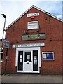
Petersfield means business (239)
Life Church Centre, Frank Westwood Emporium, Chapel Street It provides affordable housing as part of its Christian Mission. It pays rent to the owner of this site. At the margins, it has to be a grey area. You could say Petersfield Parish Church sells a guidebook, but I didn't include it in the survey
Image: © Basher Eyre
Taken: 27 Oct 2019
0.00 miles
3
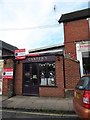
Petersfield means business (70)
Carters, Provender for Pets
(Chapel Street)
Image: © Basher Eyre
Taken: 27 Oct 2019
0.00 miles
4
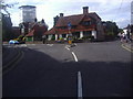
Chapel Street Petersfield
At the junction of Station Road
Image: © David Howard
Taken: 7 Aug 2011
0.01 miles
5
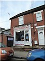
Petersfield means business (69)
Petersfield Barber Shop, Chapel Street
Image: © Basher Eyre
Taken: 27 Oct 2019
0.01 miles
6
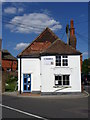
No.57 Chapel Street, Petersfield
There is an Ordnance Survey bench mark on the northwest face.
Image: © Maigheach-gheal
Taken: 31 Aug 2010
0.02 miles
7
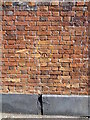
Bench Mark, Chapel Street
The bench mark is to be found on the northwest face of the building http://www.geograph.org.uk/photo/2051709 and for further information on the bench mark http://www.bench-marks.org.uk/bm35441
A bench mark is an Ordnance Survey arrowhead sign found on walls, bridges, churches and specially erected triangulation pillars where the altitude above sea-level has been accurately measured by surveyors. The arrowhead points to a horizontal line above it which marks the exact altitude.
With rivets and pivots there is no datum (horizontal line) cut, the pointed-to horizontal surface defining the datum height.
Image: © Maigheach-gheal
Taken: 31 Aug 2010
0.02 miles
8
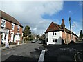
107: Going through a tightwind (clockwise)
Junction of Chapel Street and Windsor Road
Image: © Basher Eyre
Taken: 12 Mar 2022
0.02 miles
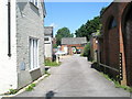
10

Petersfield means business (232)
"I said 'Can I get a tattoo?' Shall I speak up?" but he seemed to be the strong silent type so in the end I didn't get a Drum Lane tattoo. Shame....
Image: © Basher Eyre
Taken: 27 Oct 2019
0.02 miles