
IMAGES TAKEN NEAR TO
East Meon, PETERSFIELD, GU32 1PP
Introduction
This page details the photographs taken nearby to GU32 1PP by members of the Geograph project.
The Geograph project started in 2005 with the aim of publishing, organising and preserving representative images for every square kilometre of Great Britain, Ireland and the Isle of Man.

There are currently over 7.5m images from over14,400 individuals and you can help contribute to the project by visiting https://www.geograph.org.uk
Image Map
Images are licensed for reuse under creativecommons.org/licenses/by-sa/2.0
Notes
- Clicking on the map will re-center to the selected point.
- The higher the marker number, the further away the image location is from the centre of the postcode.
Image Listing (19 Images Found)
Images are licensed for reuse under creativecommons.org/licenses/by-sa/2.0
Image
Details
Distance
1
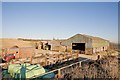
Garston Dairy, East Meon
That is what the notice says, but I don't think this is still functioning as a dairy even though there were cattle within the barn. The land seems to be mainly arable and these buildings are looking a bit dilapidated now.
Image: © Peter Facey
Taken: 12 Dec 2007
0.02 miles
2
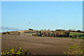
Garston Dairy
So called on the map, yet the fields around are all arable.
Image: © Robin Webster
Taken: 19 Nov 2013
0.03 miles
3
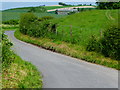
Farm buildings seen from road below Coombe Cross
I saw these buildings earlier from the west - see Image
Image: © Shazz
Taken: 31 May 2014
0.04 miles
5

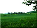
Footpath from Halnaker Lane to Garston Dairy, nr East Meon
For closer view of these farm buildings, see Image Forty Acres Cottage is beyond them.
Image: © Peter Facey
Taken: 12 Dec 2007
0.04 miles
6
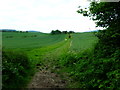
Footpath east towards farm buildings
See also http://www.geograph.org.uk/photo/632543.
Image: © Shazz
Taken: 31 May 2014
0.05 miles
7
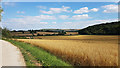
Barley ready for harvesting on Duncombe Farm
At right woodland on the side of Small Down. In distance: Butser Hill.
Image: © Peter Facey
Taken: 14 Aug 2016
0.06 miles
8
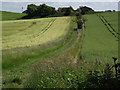
Path to East Meon
Grassy downland footpath heading from Halnaker Lane towards Garston Dairy on the hill brow. Wheat is growing in the field to the right.
Image: © Colin Smith
Taken: 19 Jun 2012
0.12 miles
9
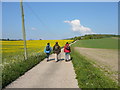
Drive leading from East Meon towards Halnaker Lane
Image: © Colin Park
Taken: 13 May 2010
0.16 miles
10
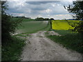
Henwood Down
View looking east from Halnaker Lane.
Image: © Chris Heaton
Taken: 12 May 2010
0.16 miles