IMAGES TAKEN NEAR TO
Heath Road, PETERSFIELD, GU31 4DX
Introduction
This page details the photographs taken nearby to Heath Road, GU31 4DX by members of the Geograph project.
The Geograph project started in 2005 with the aim of publishing, organising and preserving representative images for every square kilometre of Great Britain, Ireland and the Isle of Man.

There are currently over 7.5m images from over14,400 individuals and you can help contribute to the project by visiting https://www.geograph.org.uk
Image Map
Images are licensed for reuse under creativecommons.org/licenses/by-sa/2.0
Notes
- Clicking on the map will re-center to the selected point.
- The higher the marker number, the further away the image location is from the centre of the postcode.
Image Listing (1412 Images Found)
Images are licensed for reuse under creativecommons.org/licenses/by-sa/2.0
Image
Details
Distance
1
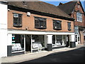
Petersfield means business (146)
Lab99, a gym opposite Petersfield Town Hall
Image: © Basher Eyre
Taken: 27 Oct 2019
0.00 miles
2
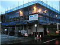
Scaffolding on The Red Lion in Petersfield town centre
Image: © Basher Eyre
Taken: 23 Dec 2009
0.01 miles
3
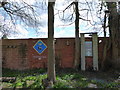
2016: a year on Geograph (Day 121)
Memorial garden in College Street: Charlie Dickens was a local scout master although I had always understood his name was spelt Dickins https://books.google.co.uk/books?id=CgU7AwAAQBAJ&pg=PT8&lpg=PT8&dq=charlie+dickins+scouts+petersfield&source=bl&ots=om3H3_kPJO&sig=2O-J90YunC8OK1UCr6eUZr_fENw&hl=en&sa=X&ved=0ahUKEwjljvm-o7bMAhVKIsAKHeUTB_kQ6AEIKDAD#v=onepage&q=charlie%20dickins%20scouts%20petersfield&f=false https://books.google.co.uk/books?id=VwY7AwAAQBAJ&pg=PT217&lpg=PT217&dq=charlie+dickins+scouts+petersfield&source=bl&ots=VYWJtOcfAS&sig=UY538wXBZ3baBhNcg3BK_2oEhOE&hl=en&sa=X&ved=0ahUKEwjljvm-o7bMAhVKIsAKHeUTB_kQ6AEIHDAA#v=onepage&q=charlie%20dickins%20scouts%20petersfield&f=false http://www.chichester.co.uk/news/local/scouts-bury-time-capsules-in-public-garden-1-699441
Image: © Basher Eyre
Taken: 30 Apr 2016
0.02 miles
4
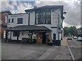
The Red Lion - Survived the lockdown
Happily The Red Lion survived the lockdown and is once again open for business as usual.
Image
Image: © Martyn Pattison
Taken: 25 Jun 2022
0.03 miles
5
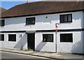
An ancient inn
Despite its unprepossessing appearance this outbuilding of The Red Lion is one of Petersfield's oldest buildings.
Image: © Basher Eyre
Taken: 7 Jun 2008
0.03 miles
6
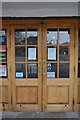
The Red Lion - closed for the duration
Although Wetherspoon resisted the initial closure orders their pubs are now closed for the duration of the Coronavirus lockdown.
Happily The Red Lion re-opened Image
Image: © Martyn Pattison
Taken: 29 Mar 2020
0.03 miles
7
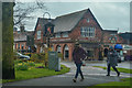
Petersfield : Dragon Street
Looking across to Dragon Street with the Folly Market and Antiques Centre in view.
Image: © Lewis Clarke
Taken: 28 Mar 2018
0.03 miles
8
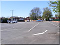
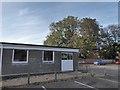
Deserted car park - Petersfield Festival Hall
The Festival Hall car park is always busy, and would normally be almost full on a midweek lunchtime, it is now almost deserted as a result of the Coronavirus lockdown.
Image: © Martyn Pattison
Taken: 20 Apr 2020
0.03 miles
9
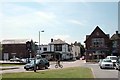
Junction of Tor Way, College Street, and Dragon Street.
The large building on the far left was built in 1822 as a Masonic Hall, the white pub is the Red Lion, which dates back to the 16th C. and had its own brewery in what is now the car park until it burned down in 1933. The Folly Market is a small indoor market which also houses a wine bar on the first floor and a "beer" bar on the ground floor.
Image: © Martyn Pattison
Taken: 20 Jun 2005
0.03 miles