IMAGES TAKEN NEAR TO
Tunbridge Lane, LIPHOOK, GU30 7QA
Introduction
This page details the photographs taken nearby to Tunbridge Lane, GU30 7QA by members of the Geograph project.
The Geograph project started in 2005 with the aim of publishing, organising and preserving representative images for every square kilometre of Great Britain, Ireland and the Isle of Man.

There are currently over 7.5m images from over14,400 individuals and you can help contribute to the project by visiting https://www.geograph.org.uk
Image Map
Images are licensed for reuse under creativecommons.org/licenses/by-sa/2.0
Notes
- Clicking on the map will re-center to the selected point.
- The higher the marker number, the further away the image location is from the centre of the postcode.
Image Listing (23 Images Found)
Images are licensed for reuse under creativecommons.org/licenses/by-sa/2.0
Image
Details
Distance
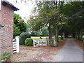
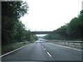
2
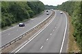
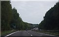
A3
The A3 where the B3004 crosses it at the edge of Liphook.
Image: © Ben Gamble
Taken: 23 Jul 2005
0.08 miles
4
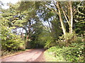
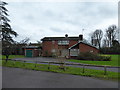
2020 vision: Day 290
Mid section of Tunbridge Lane
Temperature 11C
BBC Radio Four, Midday News Bulletin, first headline: deadlock between local leaders in the North of England and government ministers has been "partially broken"
Image: © Basher Eyre
Taken: 16 Oct 2020
0.11 miles
5
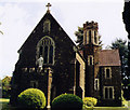
The Immaculate RC Church, Liphook: mid January 2016
Image: © Basher Eyre
Taken: 18 Jan 2016
0.14 miles
6

Field with Highland cattle
The one at the front appeared to be on guard.
Image: © Shazz
Taken: 9 Jan 2009
0.14 miles
8
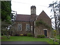
The Immaculate RC Church, Liphook: presbytery
Image: © Basher Eyre
Taken: 18 Jan 2016
0.15 miles
9
The Immaculate Conception, Liphook
Built in 1911.
Image: © Michael FORD
Taken: Unknown
0.15 miles
10
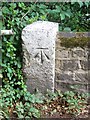
Bench Mark, Bramshott
On the bridge Image parapet is a bench mark. For more information about the cut mark http://www.bench-marks.org.uk/bm35061
A bench mark is an Ordnance Survey arrowhead sign found on walls, bridges, churches and specially erected triangulation pillars where the altitude above sea-level has been accurately measured by surveyors. The arrowhead points to a horizontal line above it which marks the exact altitude.
With rivets and pivots there is no datum (horizontal line) cut, the pointed-to horizontal surface defining the datum height.
Image: © Maigheach-gheal
Taken: 25 Jul 2010
0.16 miles