
IMAGES TAKEN NEAR TO
Iping Road, LIPHOOK, GU30 7NA
Introduction
This page details the photographs taken nearby to Iping Road, GU30 7NA by members of the Geograph project.
The Geograph project started in 2005 with the aim of publishing, organising and preserving representative images for every square kilometre of Great Britain, Ireland and the Isle of Man.

There are currently over 7.5m images from over14,400 individuals and you can help contribute to the project by visiting https://www.geograph.org.uk
Image Map
Images are licensed for reuse under creativecommons.org/licenses/by-sa/2.0
Notes
- Clicking on the map will re-center to the selected point.
- The higher the marker number, the further away the image location is from the centre of the postcode.
Image Listing (11 Images Found)
Images are licensed for reuse under creativecommons.org/licenses/by-sa/2.0
Image
Details
Distance
3
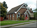
Milland Evangelical Church
As is often the case with the newer non-conformist churches, some way out from the village centre.
Image: © Robin Webster
Taken: 4 Aug 2012
0.11 miles
4
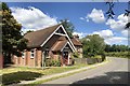
Church near Milland
Milland Evangelical Church, which originally started back in 1909 as the Milland Mission Hall.
Image: © Chris Thomas-Atkin
Taken: 21 Jul 2020
0.11 miles
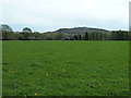
6
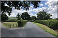
Roman Posting Station
On the Iping Road looking southwards. The slight rise in the road just ahead indicates the site of a Roman Posting Station on the OS Map.
Historic England records this as a Scheduled Monument. It is described as a Mansio, which is a mainly masonry built building, providing accommodation and stabling for travellers associated with the Cursus Publicus - the provincial Postal Service of Roman Britain.
See https://historicengland.org.uk/listing/the-list/list-entry/1015887
Image: © Chris Thomas-Atkin
Taken: 21 Jul 2020
0.17 miles
7
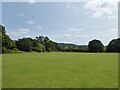
Milland Marsh
The name of the field according to Chithurst's 1840 tithe map that was once part of a much larger common. This section is located to the south east of Waldergrove Farm and is bounded to the east by Iping Road.
Image: © Simon Carey
Taken: 17 Aug 2024
0.19 miles
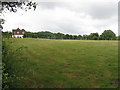
10
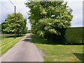
Avenue at Waldegrove Farm leading to Milland Road
Image: © Shazz
Taken: 16 Jun 2009
0.24 miles