IMAGES TAKEN NEAR TO
Wheatsheaf Enclosure, LIPHOOK, GU30 7EJ
Introduction
This page details the photographs taken nearby to Wheatsheaf Enclosure, GU30 7EJ by members of the Geograph project.
The Geograph project started in 2005 with the aim of publishing, organising and preserving representative images for every square kilometre of Great Britain, Ireland and the Isle of Man.

There are currently over 7.5m images from over14,400 individuals and you can help contribute to the project by visiting https://www.geograph.org.uk
Image Map
Images are licensed for reuse under creativecommons.org/licenses/by-sa/2.0
Notes
- Clicking on the map will re-center to the selected point.
- The higher the marker number, the further away the image location is from the centre of the postcode.
Image Listing (32 Images Found)
Images are licensed for reuse under creativecommons.org/licenses/by-sa/2.0
Image
Details
Distance
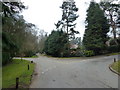
2
Anti-clockwise circumnavigation of Liphook (15)
Looking towards Shufflesheeps.
Image: © Basher Eyre
Taken: 29 Jan 2011
0.10 miles
3
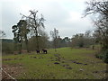
Anti-clockwise circumnavigation of Liphook (16)
Interested equine spectators.
Image: © Basher Eyre
Taken: 29 Jan 2011
0.10 miles
5
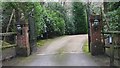
Entrance to The White House
This is a house near Liphook on a byway used by the Sussex Border Path. This is in West Sussex.
Image: © Shazz
Taken: 8 Feb 2009
0.11 miles
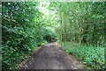
6
Anti-clockwise circumnavigation of Liphook (12)
Image: © Basher Eyre
Taken: 29 Jan 2011
0.11 miles
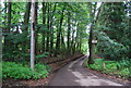
10
Anti-clockwise circumnavigation of Liphook (13)
Image: © Basher Eyre
Taken: 29 Jan 2011
0.12 miles