IMAGES TAKEN NEAR TO
Manor Fields, LIPHOOK, GU30 7BS
Introduction
This page details the photographs taken nearby to Manor Fields, GU30 7BS by members of the Geograph project.
The Geograph project started in 2005 with the aim of publishing, organising and preserving representative images for every square kilometre of Great Britain, Ireland and the Isle of Man.

There are currently over 7.5m images from over14,400 individuals and you can help contribute to the project by visiting https://www.geograph.org.uk
Image Map
Images are licensed for reuse under creativecommons.org/licenses/by-sa/2.0
Notes
- Clicking on the map will re-center to the selected point.
- The higher the marker number, the further away the image location is from the centre of the postcode.
Image Listing (20 Images Found)
Images are licensed for reuse under creativecommons.org/licenses/by-sa/2.0
Image
Details
Distance
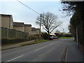
1
Anti-clockwise circumnavigation of Liphook (57)
Joggers passing the junction of The Maltings and Haslemere Road.
Image: © Basher Eyre
Taken: 29 Jan 2011
0.05 miles
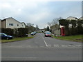
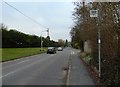
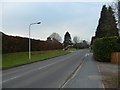
2
Haslemere Road, Liphook
At the junction of The Maltings
Image: © David Howard
Taken: 7 Aug 2011
0.06 miles
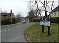
3
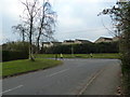
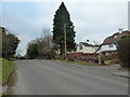
Looking from Haslemere Road into Manor Fields
Image: © Basher Eyre
Taken: 29 Jan 2011
0.06 miles
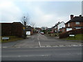
4
The Maltings at the Haslemere Road junction
Image: © David Howard
Taken: 7 Aug 2011
0.06 miles
5
Anti-clockwise circumnavigation of Liphook (55)
Approaching a telephone box in Haslemere Road.
Image: © Basher Eyre
Taken: 29 Jan 2011
0.07 miles
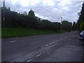
6
Anti-clockwise circumnavigation of Liphook (56)
Approaching a bus stop in Haslemere Road.
Image: © Basher Eyre
Taken: 29 Jan 2011
0.07 miles
8
Looking from Haslemere Road into Chiltlee Close
Image: © Basher Eyre
Taken: 29 Jan 2011
0.10 miles
9
Anti-clockwise circumnavigation of Liphook (54)
Taken in Haslemere Road, just past Hazlebank Close.
Image: © Basher Eyre
Taken: 29 Jan 2011
0.11 miles
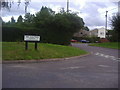
10
Anti-clockwise circumnavigation of Liphook (58)
Approaching the staggered crossroads of Erles Road (nearest) and Chiltee Close (slightly further).
Image: © Basher Eyre
Taken: 29 Jan 2011
0.12 miles