IMAGES TAKEN NEAR TO
Canada Grove, MIDHURST, GU29 9AF
Introduction
This page details the photographs taken nearby to Canada Grove, GU29 9AF by members of the Geograph project.
The Geograph project started in 2005 with the aim of publishing, organising and preserving representative images for every square kilometre of Great Britain, Ireland and the Isle of Man.

There are currently over 7.5m images from over14,400 individuals and you can help contribute to the project by visiting https://www.geograph.org.uk
Image Map
Images are licensed for reuse under creativecommons.org/licenses/by-sa/2.0
Notes
- Clicking on the map will re-center to the selected point.
- The higher the marker number, the further away the image location is from the centre of the postcode.
Image Listing (25 Images Found)
Images are licensed for reuse under creativecommons.org/licenses/by-sa/2.0
Image
Details
Distance
1

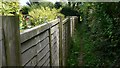
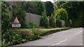
Attractive cottage at Crossways in Easebourne
Image: © Shazz
Taken: 13 Jul 2009
0.05 miles

3
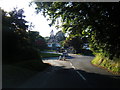
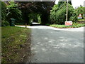
Wheelbarrow Castle approaching A286 junction
Image: © Colin Pyle
Taken: 12 Aug 2012
0.07 miles
4
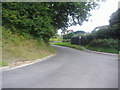
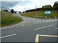
Wheelbarrow Castle, Easebourne
The name of the actual road.
Image: © David Howard
Taken: 22 Aug 2011
0.07 miles
5
Annoying sign at the junction of Upperfield and Hollist Lane
Why just pets and children?
Image: © Shazz
Taken: 13 Jul 2009
0.09 miles
6
Hollist Lane at Easebourne
Upperfield is a small private estate.
Image: © Dave Spicer
Taken: 19 Jun 2011
0.09 miles

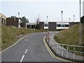
8
Midhurst Rother College
On the oddly named road, Wheelbarrow Castle.
Image: © Dave Spicer
Taken: 19 Jun 2011
0.13 miles