
IMAGES TAKEN NEAR TO
Stedham, MIDHURST, GU29 0PU
Introduction
This page details the photographs taken nearby to GU29 0PU by members of the Geograph project.
The Geograph project started in 2005 with the aim of publishing, organising and preserving representative images for every square kilometre of Great Britain, Ireland and the Isle of Man.

There are currently over 7.5m images from over14,400 individuals and you can help contribute to the project by visiting https://www.geograph.org.uk
Image Map
Images are licensed for reuse under creativecommons.org/licenses/by-sa/2.0
Notes
- Clicking on the map will re-center to the selected point.
- The higher the marker number, the further away the image location is from the centre of the postcode.
Image Listing (14 Images Found)
Images are licensed for reuse under creativecommons.org/licenses/by-sa/2.0
Image
Details
Distance
1
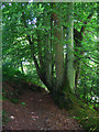
Footpath to Stanhope Lane
Descending the eastern side of a small valley towards a small country lane. The path begins by branching of a restricted byway near Ash House.
Image: © Simon Carey
Taken: 28 Jun 2008
0.05 miles
2

Iping Cross Country Course
Eventing course based in the grounds of Hammerwood House there are a large number of jumps in the vicinity, this one is next to the footpath as it reaches Stanhope Lane.
Image: © Simon Carey
Taken: 28 Jun 2008
0.09 miles
3
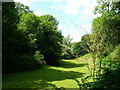
Pasture near Ash House
The field is in a small valley of an unnamed tributary of the Rother. Taken from the footpath that runs along the eastern slope between Ash House and Stanhope Lane.
Image: © Simon Carey
Taken: 28 Jun 2008
0.10 miles
4
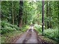
Lane from Ash House
This part appears to be a public road, but north of Ash House it is a restricted byway, and the surface degenerates.
Image: © Robin Webster
Taken: 31 Jul 2012
0.11 miles
5

Horse jumps by footpath 1133/1
The footpath follows the course of the tributary of the River Rother.
Image: © Dave Spicer
Taken: 29 Aug 2011
0.14 miles
6

Sign Post, Stedham Lane, West Sussex
Sign Post at junction of Stedham Lane and the road to Crouchhouse Farm (left) and Brambling Farm (right). Grid Line 86 passes slightly to the right of the sign post.
Image: © Anthony Brunning
Taken: 25 Sep 2005
0.16 miles
7

Water Jump, Iping Cross Country Course
Utilising a small unnamed stream that joins the Rother a little way to the south. A footpath runs from Stanhope Lane to Iping village across parts of the course and some of the routes can be a little confusing, particularly this bit where a footbridge behind me fooled me into thinking the footpath went this way.
Image: © Simon Carey
Taken: 28 Jun 2008
0.17 miles

9

Water jump on horse trails course
The New Lipchis Way also follows the stream.
Image: © Dave Spicer
Taken: 29 Aug 2011
0.20 miles
10

Electricity Transmission Line, Stedham, West Sussex
A section of the 400k electricity transmission line crossing grid square SU8623 north of Stedham.
Image: © Anthony Brunning
Taken: 25 Sep 2005
0.20 miles