1
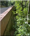
The back entrance to the "Royal Oak" at Midhurst
This is in Oaklands Lane whereas the front entrance is on Chichester Road (A286).
Image: © Shazz
Taken: 12 Dec 2010
0.10 miles
2
The Royal Oak PH, south of Midhurst
The Royal Oak is set in its grounds off the A286 to the east, a little south of Midhurst on the way to Cocking. It serves a good selection of beer and food.
See their own website here http://www.royaloakmidhurst.co.uk
Image: © Rob Farrow
Taken: 31 Oct 2015
0.12 miles
3
The Royal Oak public house
On the southern outskirts of Midhurst.
Image: © Rod Allday
Taken: 15 Apr 2017
0.12 miles
4
The Royal Oak by the A286 Chichester Road
Image: © Dave Spicer
Taken: 21 Aug 2011
0.12 miles
5
The Royal Oak public house, Midhurst
Image: © nick macneill
Taken: 15 Oct 2012
0.13 miles
6
The Cobden Obelisk
This lies on the Serpent Trail. The monument was erected in 1868 and further information is at http://publicsculpturesofsussex.co.uk/object?id=278.
Image: © Shazz
Taken: 6 Oct 2008
0.14 miles
7
Richard Cobden memorial obelisk at Cocking Causeway
The plinth bears the inscription 'FREE TRADE, PEACE, GOODWILL AMONG NATIONS'. The memorial was erected by Henry Court, a tenant farmer. The great reformer, statesman & idealist was born on his grandfather's farm at nearby Dunford.
Image: © Rod Allday
Taken: 15 Apr 2017
0.15 miles
8
Obelisk by Oaklands Lane
Inscription reads: Free trade peace and goodwill among nations.
Image: © Dave Spicer
Taken: 2 Oct 2010
0.16 miles
9
Old railway
Looking down towards the disused track bed of the Midhurst to Pulborough railway line. Oaklands Lane, on the left, crosses the railway bridge.
To the right the railway line entered a cutting, now overgrown with trees, then presumably went through a tunnel to arrive at Midhurst.
Image: © Chris Thomas-Atkin
Taken: 25 Aug 2021
0.21 miles
10
Oaklands Lane junction with the A286
Image: © Dave Spicer
Taken: 2 Oct 2010
0.22 miles


