
IMAGES TAKEN NEAR TO
Heyshott, MIDHURST, GU29 0DG
Introduction
This page details the photographs taken nearby to GU29 0DG by members of the Geograph project.
The Geograph project started in 2005 with the aim of publishing, organising and preserving representative images for every square kilometre of Great Britain, Ireland and the Isle of Man.

There are currently over 7.5m images from over14,400 individuals and you can help contribute to the project by visiting https://www.geograph.org.uk
Image Map
Images are licensed for reuse under creativecommons.org/licenses/by-sa/2.0
Notes
- Clicking on the map will re-center to the selected point.
- The higher the marker number, the further away the image location is from the centre of the postcode.
Image Listing (8 Images Found)
Images are licensed for reuse under creativecommons.org/licenses/by-sa/2.0
Image
Details
Distance
1

Cowdray Estate cottage east of Bex Mill
The estate's yellow paintwork seems to be everywhere you look in this area south of Midhurst.
Image: © Stefan Czapski
Taken: 16 Jun 2015
0.03 miles
2
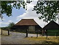
Weather-boarded barn near Bex Mill
To the east of Costers Brook.
Image: © Stefan Czapski
Taken: 16 Jun 2015
0.03 miles
3
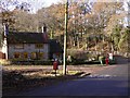
Cottage near Bex Mill
There have been some changes since the 2006 picture (see http://www.geograph.org.uk/photo/225556).
Image: © Shazz
Taken: 12 Dec 2010
0.04 miles
4
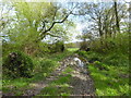
A muddy field entrance off Mill Lane Heyshott Green
Image: © Rod Allday
Taken: 15 Apr 2017
0.08 miles
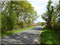
6
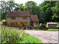
Cottage near Bex Mill
On Mill Lane just before the bridge over Costers Brook.
Image: © Simon Carey
Taken: 24 Aug 2006
0.14 miles
7
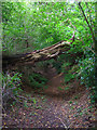
Fallen tree
Providing an impromptu bridge on the bridleway that connects Dunford and Westercroft Copse on Mill Lane.
Image: © Simon Carey
Taken: 24 Aug 2006
0.20 miles
8
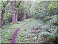
Bridleway, Heyshott Green
The bridleway takes riders and walkers along the woodlands edge from Mill Lane to Walkers Farm.
Image: © Maigheach-gheal
Taken: 26 May 2009
0.24 miles