IMAGES TAKEN NEAR TO
Southway, GUILDFORD, GU2 8DF
Introduction
This page details the photographs taken nearby to Southway, GU2 8DF by members of the Geograph project.
The Geograph project started in 2005 with the aim of publishing, organising and preserving representative images for every square kilometre of Great Britain, Ireland and the Isle of Man.

There are currently over 7.5m images from over14,400 individuals and you can help contribute to the project by visiting https://www.geograph.org.uk
Image Map
Images are licensed for reuse under creativecommons.org/licenses/by-sa/2.0
Notes
- Clicking on the map will re-center to the selected point.
- The higher the marker number, the further away the image location is from the centre of the postcode.
Image Listing (31 Images Found)
Images are licensed for reuse under creativecommons.org/licenses/by-sa/2.0
Image
Details
Distance
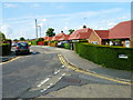
5
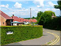
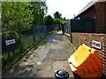
Looking over the hedge at the west end of Firsway
Although not marked on the name sign Firsway is not a through road except for pedestrians, pedal cyclists and possibly motor cyclists.
Image: © Shazz
Taken: 24 Jun 2014
0.16 miles
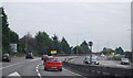
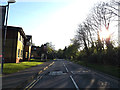
7
Railway passes Stag Hill Campus
At The University of Surrey
Image: © Geographer
Taken: 15 Apr 2014
0.19 miles
9
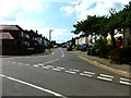
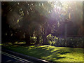
Looking along Woodside Road from the junction with Firsway
Image: © Shazz
Taken: 24 Jun 2014
0.19 miles
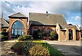
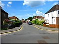
10
Perimeter Road on Stag Hill Campus
Looking towards the entrance at The University of Surrey
Image: © Geographer
Taken: 15 Apr 2014
0.20 miles