IMAGES TAKEN NEAR TO
London Road, PETWORTH, GU28 9ND
Introduction
This page details the photographs taken nearby to London Road, GU28 9ND by members of the Geograph project.
The Geograph project started in 2005 with the aim of publishing, organising and preserving representative images for every square kilometre of Great Britain, Ireland and the Isle of Man.

There are currently over 7.5m images from over14,400 individuals and you can help contribute to the project by visiting https://www.geograph.org.uk
Image Map
Images are licensed for reuse under creativecommons.org/licenses/by-sa/2.0
Notes
- Clicking on the map will re-center to the selected point.
- The higher the marker number, the further away the image location is from the centre of the postcode.
Image Listing (17 Images Found)
Images are licensed for reuse under creativecommons.org/licenses/by-sa/2.0
Image
Details
Distance
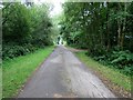
1
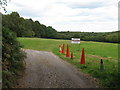
Track to Colhook Common
Public bridleway 2942 off A283 to Balloon launch field and Caravan Club site.
Image: © Peter Holmes
Taken: 12 Aug 2017
0.05 miles
2
Surveillance of bridleway
Public bridleway 2942 to Colhook Common.
Image: © Peter Holmes
Taken: 12 Aug 2017
0.05 miles
3
Direction sign for Balloon Launchfield
Normally this is for hot air balloons but as there is some celebration event nearby off the same lane, the party balloons give a different impression.
Image: © Dave Spicer
Taken: 5 Sep 2009
0.10 miles
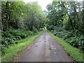
4
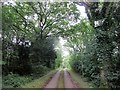
Lane from Blackwool Farm
Public bridleway 2942 from Caravan Club site to A283.
Image: © Peter Holmes
Taken: 12 Aug 2017
0.10 miles
5
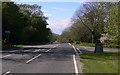
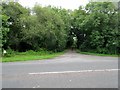
Looking north on the A283 at the entrance to Colhook Industrial Estate
This is a fairly recent industrial estate, certainly postdating my OS Pathfinder map of 1984.
Image: © Shazz
Taken: 30 Apr 2010
0.11 miles
6
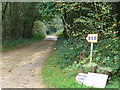
Bridleway in Colhook Common
The signs lead people to the "balloon launch field".
Image: © Colin Smith
Taken: 14 Oct 2006
0.11 miles
7
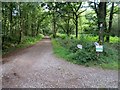
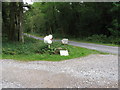
Track Junction
Public bridleway 2942 to Colhook Common ahead whilst to the right public footpath 598 proceeds to Blackwool Farm.
Image: © Peter Holmes
Taken: 12 Aug 2017
0.12 miles
8
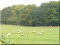
West of Colhook Common
Pheasants and sheep share the pasture by the A285.
Image: © Colin Smith
Taken: 14 Oct 2006
0.14 miles
9
Lane to Blackwool Farm
Public footpath 598.
Image: © Peter Holmes
Taken: 12 Aug 2017
0.16 miles