
IMAGES TAKEN NEAR TO
Pipers Lane, PETWORTH, GU28 9JB
Introduction
This page details the photographs taken nearby to Pipers Lane, GU28 9JB by members of the Geograph project.
The Geograph project started in 2005 with the aim of publishing, organising and preserving representative images for every square kilometre of Great Britain, Ireland and the Isle of Man.

There are currently over 7.5m images from over14,400 individuals and you can help contribute to the project by visiting https://www.geograph.org.uk
Image Map
Images are licensed for reuse under creativecommons.org/licenses/by-sa/2.0
Notes
- Clicking on the map will re-center to the selected point.
- The higher the marker number, the further away the image location is from the centre of the postcode.
Image Listing (32 Images Found)
Images are licensed for reuse under creativecommons.org/licenses/by-sa/2.0
Image
Details
Distance
1
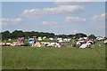
Northchapel Steam Rally
Annual gathering of steam engines at Hortons Farm.
Image: © Ben Gamble
Taken: 21 Aug 2005
0.09 miles
2
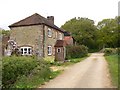
Peacock's Farm near Northchapel
This section of the bridleway passing the farmhouse is absolutely straight for half a mile.
Image: © Shazz
Taken: 30 Apr 2010
0.11 miles
3
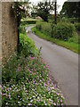
Piper's Lane
Country lane at Peacock's Farm, east of Northchapel.
http://www.gravelroots.net/northchapel
Image: © Colin Smith
Taken: 5 Jul 2012
0.11 miles
4
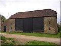
Magnificent barn at Peacock's Farm
A different view of the barn was submitted in 2009 (see http://www.geograph.org.uk/photo/1163474 ).
Image: © Shazz
Taken: 30 Apr 2010
0.11 miles
5
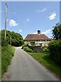
Peacock's Farmhouse, Pipers Lane
Dating back to at least the 17th century.
Image: © Simon Carey
Taken: 2 Jun 2024
0.11 miles
6
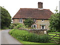
Peacock's Farm
Substantial stone building on Piper's Lane, east of Northchapel.
http://www.gravelroots.net/northchapel
Image: © Colin Smith
Taken: 5 Jul 2012
0.11 miles
7
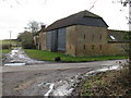
Brick barn at Peacock's Farm
The road running from right to left is from North Chapel to Balls Cross or Ebernoe
Image: © Dave Spicer
Taken: 14 Feb 2009
0.12 miles
8
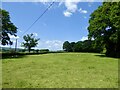
Garlands Croft
The name of the field according to Northchapel's 1837 tithe map located to the north of Pipers Lane.
Image: © Simon Carey
Taken: 2 Jun 2024
0.13 miles
9
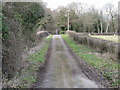
Bridleway to Peacock's Farm
The roof of the porch to the farm is just visible above the left hand hedge
Image: © Dave Spicer
Taken: 14 Feb 2009
0.13 miles
10

Stonebuilt barn at Peacock's Farm: end elevation
Image: © Stefan Czapski
Taken: 19 Jul 2015
0.13 miles