IMAGES TAKEN NEAR TO
Lurgashall, PETWORTH, GU28 9EU
Introduction
This page details the photographs taken nearby to GU28 9EU by members of the Geograph project.
The Geograph project started in 2005 with the aim of publishing, organising and preserving representative images for every square kilometre of Great Britain, Ireland and the Isle of Man.

There are currently over 7.5m images from over14,400 individuals and you can help contribute to the project by visiting https://www.geograph.org.uk
Image Map
Images are licensed for reuse under creativecommons.org/licenses/by-sa/2.0
Notes
- Clicking on the map will re-center to the selected point.
- The higher the marker number, the further away the image location is from the centre of the postcode.
Image Listing (60 Images Found)
Images are licensed for reuse under creativecommons.org/licenses/by-sa/2.0
Image
Details
Distance
1
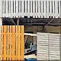
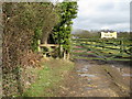
Outbuilding near Park Farm
"Woodcraft Folk" - https://woodcraft.org.uk/about-woodcraft-folk/our-aims-principles/ - have a campsite hereabouts. I think this building belongs to them.
Image: © Ian Hawfinch
Taken: 23 Feb 2022
0.02 miles
2
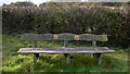
Memorial seat at Park Farm Trim Trail near Lurgashall
Image: © Shazz
Taken: 22 Oct 2009
0.03 miles
3
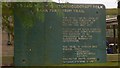
Sign in field
This is the second fitness trail I have walked by this month (see http://www.geograph.org.uk/photo/1520117 ).
Image: © Shazz
Taken: 22 Oct 2009
0.03 miles
4
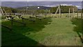
Park Farm Trim Trail
This shows a section of the course.
Image: © Shazz
Taken: 22 Oct 2009
0.03 miles
5
Narrow footpath beside entrance to Pinto
Image: © Dave Spicer
Taken: 27 Feb 2010
0.04 miles
6
Footpath near Lurgashall
To the left of the gate is a narrow enclosed footpath.
Image: © Shazz
Taken: 22 Oct 2009
0.05 miles
8
Old Ground
The name of the field according to Lurgashall's 1841 tithe map bounded to the west by Spring Coppice.
Image: © Simon Carey
Taken: 2 Aug 2024
0.09 miles
9
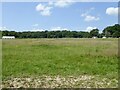
Lodge Field
The name of the field according to Lurgashall's 1841 tithe map that is now used by Park Farm as a camping site.
Image: © Simon Carey
Taken: 2 Aug 2024
0.11 miles
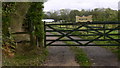
10
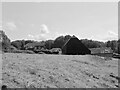
Park Lane Cottage
The barns on the right are marked on Lurgashall's 1841 tithe map whilst the cottage is not. However, it does appear on the 1875 OS map.
Image: © Simon Carey
Taken: 2 Aug 2024
0.12 miles