IMAGES TAKEN NEAR TO
Heath End, PETWORTH, GU28 0JG
Introduction
This page details the photographs taken nearby to Heath End, GU28 0JG by members of the Geograph project.
The Geograph project started in 2005 with the aim of publishing, organising and preserving representative images for every square kilometre of Great Britain, Ireland and the Isle of Man.

There are currently over 7.5m images from over14,400 individuals and you can help contribute to the project by visiting https://www.geograph.org.uk
Image Map
Images are licensed for reuse under creativecommons.org/licenses/by-sa/2.0
Notes
- Clicking on the map will re-center to the selected point.
- The higher the marker number, the further away the image location is from the centre of the postcode.
Image Listing (17 Images Found)
Images are licensed for reuse under creativecommons.org/licenses/by-sa/2.0
Image
Details
Distance
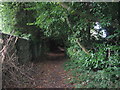
1
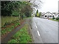
The Serpent Trail through Heath End
Bus stop on A285 Compass bus service 99 (Flexible Route) and 99A (limited service) to Chichester. The Serpent Trail is a 64 mile long distance footpath from Haslemere to Petersfield. The route is designed to join up the many heathland areas on greensand in the western Weald.
Image: © Peter Holmes
Taken: 16 Apr 2016
0.03 miles
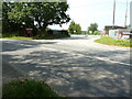
3
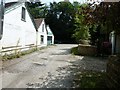
Bridleway junction with the A285
The buildings on the left belong to West Sussex Specialist Cars.
Image: © Dave Spicer
Taken: 31 Jul 2011
0.04 miles
4
The Serpent Trail to Burton Park and Sutton Common
Public bridleway 2253 to North Lodge. The Serpent Trail is a 64 mile long distance footpath from Haslemere to Petersfield. The route is designed to join up the many heathland areas on greensand in the western Weald.
Image: © Peter Holmes
Taken: 16 Apr 2016
0.06 miles
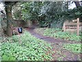
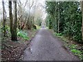
5
Bridleway through The Rough near Heath End
Image: © Dave Spicer
Taken: 22 Aug 2009
0.07 miles
8
The Serpent Trail to Duncton Common
Public bridleway 671 to Cathanger Farm. The Serpent Trail is a 64 mile long distance footpath from Haslemere to Petersfield. The route is designed to join up the many heathland areas on greensand in the western Weald.
Image: © Peter Holmes
Taken: 16 Apr 2016
0.13 miles
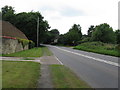
9
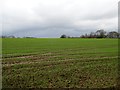
Field adjacent to A285
Young crops on arable land between A285 and Kilsham Copse.
Image: © Peter Holmes
Taken: 16 Apr 2016
0.15 miles
10
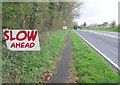
Approaching Heath End
A285 to Chichester.
Image: © Peter Holmes
Taken: 16 Apr 2016
0.15 miles