IMAGES TAKEN NEAR TO
Poltimore Road, GUILDFORD, GU2 7PX
Introduction
This page details the photographs taken nearby to Poltimore Road, GU2 7PX by members of the Geograph project.
The Geograph project started in 2005 with the aim of publishing, organising and preserving representative images for every square kilometre of Great Britain, Ireland and the Isle of Man.

There are currently over 7.5m images from over14,400 individuals and you can help contribute to the project by visiting https://www.geograph.org.uk
Image Map
Images are licensed for reuse under creativecommons.org/licenses/by-sa/2.0
Notes
- Clicking on the map will re-center to the selected point.
- The higher the marker number, the further away the image location is from the centre of the postcode.
Image Listing (185 Images Found)
Images are licensed for reuse under creativecommons.org/licenses/by-sa/2.0
Image
Details
Distance
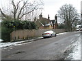
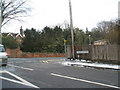
1
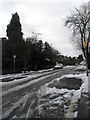
Looking from Annandale Road across the A31 to Agraria Road
Image: © Basher Eyre
Taken: 7 Feb 2009
0.01 miles
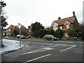
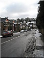
5
Crossroads of Poltimore Road with Agraria Road
Image: © Basher Eyre
Taken: 7 Feb 2009
0.03 miles
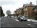
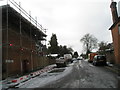
9
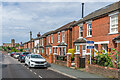
Agraria Road
c.Early 20th Century housing in Agraria Road, first shown on the 1916 25 inch map. In the background is Guildford Cathedral.
Image: © Ian Capper
Taken: 12 Sep 2022
0.04 miles