
IMAGES TAKEN NEAR TO
Oak Lodge, Lythe Hill Park, HASLEMERE, GU27 3TF
Introduction
This page details the photographs taken nearby to Oak Lodge, Lythe Hill Park, GU27 3TF by members of the Geograph project.
The Geograph project started in 2005 with the aim of publishing, organising and preserving representative images for every square kilometre of Great Britain, Ireland and the Isle of Man.

There are currently over 7.5m images from over14,400 individuals and you can help contribute to the project by visiting https://www.geograph.org.uk
Image Map
Images are licensed for reuse under creativecommons.org/licenses/by-sa/2.0
Notes
- Clicking on the map will re-center to the selected point.
- The higher the marker number, the further away the image location is from the centre of the postcode.
Image Listing (15 Images Found)
Images are licensed for reuse under creativecommons.org/licenses/by-sa/2.0
Image
Details
Distance
1
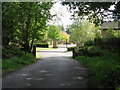
Entrance to private housing estate on Haste Hill
Image: © Dave Spicer
Taken: 18 Sep 2010
0.16 miles
2
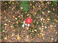
Nice example of a Fly Agaric
By footpath on Haste Hill.
Image: © Dave Spicer
Taken: 18 Sep 2010
0.17 miles
4
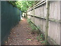
Footpath between residential gardens near Haste Hill
Image: © Dave Spicer
Taken: 18 Sep 2010
0.18 miles
5
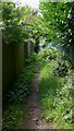
Narrow footpath off Tennyson's Lane
This is in Surrey near Haslemere.
Image: © Shazz
Taken: 25 Jul 2009
0.19 miles
7
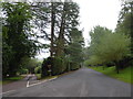
2016: a year on Geograph (Day 264)
Lythe Hill Park
Image: © Basher Eyre
Taken: 20 Sep 2016
0.19 miles
8
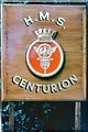
H.M.S. Centurion
HMS Centurion was the central drafting depot established at Lythehill House in 1956, and remained here until 1970 when it moved to Gosport.
Image: © Peter Jeffery
Taken: Unknown
0.20 miles
10
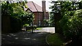
Entrance to Huntersfold on Tennyson's Lane
This is in Surrey.
Image: © Shazz
Taken: 25 Jul 2009
0.20 miles