IMAGES TAKEN NEAR TO
Grasslands Close, GU27 3FB
Introduction
This page details the photographs taken nearby to Grasslands Close, GU27 3FB by members of the Geograph project.
The Geograph project started in 2005 with the aim of publishing, organising and preserving representative images for every square kilometre of Great Britain, Ireland and the Isle of Man.

There are currently over 7.5m images from over14,400 individuals and you can help contribute to the project by visiting https://www.geograph.org.uk
Image Map (Loading...)


Getting Data...Please wait
Leaflet Map data © OpenStreetMap
Images are licensed for reuse under creativecommons.org/licenses/by-sa/2.0
Notes
- Clicking on the map will re-center to the selected point.
- The higher the marker number, the further away the image location is from the centre of the postcode.
Image Listing (190 Images Found)
Images are licensed for reuse under creativecommons.org/licenses/by-sa/2.0
Image
Details
Distance
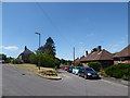
1
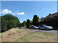
Grasslands Close, Haslemere
A new development still under construction in Haslemere.
Image: © Oscar Taylor
Taken: 18 Sep 2024
0.04 miles
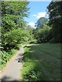
5
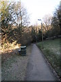
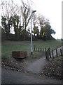
Looking down the path from Sun Brow to King's Road
Image: © Basher Eyre
Taken: 30 Jan 2010
0.09 miles
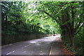
6
Lamppost at the bottom of the path from King's Road to Sun Brow
Image: © Basher Eyre
Taken: 30 Jan 2010
0.09 miles
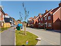
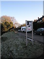
7
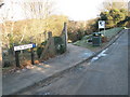
Road and path junction in Sun Brow
It takes you down to King's Road.
Image: © Basher Eyre
Taken: 30 Jan 2010
0.10 miles