IMAGES TAKEN NEAR TO
Verdley Place, HASLEMERE, GU27 3ER
Introduction
This page details the photographs taken nearby to Verdley Place, GU27 3ER by members of the Geograph project.
The Geograph project started in 2005 with the aim of publishing, organising and preserving representative images for every square kilometre of Great Britain, Ireland and the Isle of Man.

There are currently over 7.5m images from over14,400 individuals and you can help contribute to the project by visiting https://www.geograph.org.uk
Image Map (Loading...)


Getting Data...Please wait
Leaflet Map data © OpenStreetMap
Images are licensed for reuse under creativecommons.org/licenses/by-sa/2.0
Notes
- Clicking on the map will re-center to the selected point.
- The higher the marker number, the further away the image location is from the centre of the postcode.
Image Listing (10 Images Found)
Images are licensed for reuse under creativecommons.org/licenses/by-sa/2.0
Image
Details
Distance
1
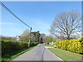
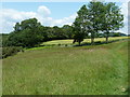
Searching southwards down the Bashire (6b)
This was the square I finished in last autumn
Image: © Basher Eyre
Taken: 3 Apr 2017
0.08 miles
2
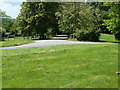
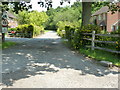
Entrance to the former Verdley Place Research Station
The Victorian house was bought in 1945 by ICI and soon became a national centre for fruit growing expertise. From 1959 to 1975 it was ICI headquarters and when under the banner of ICI Agrochemicals in 1986, Margaret Thatcher unveiled a new conference centre.
After several mergers the company left the site in 2001 and was sold to become residential housing.
Image: © Dave Spicer
Taken: 2 Jul 2011
0.10 miles
4
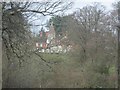
Verdley Place
Although the map says this is a "Research Station", it is now residential. It once was part of Zeneca Agrochemicals (formerly ICI), but closed a few years ago.
Image: © Ben Gamble
Taken: 2 Apr 2006
0.14 miles
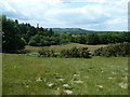
5
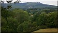
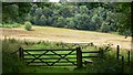
Field near Fernhurst
At the back is the high ground of Older Hill and Woolbeding Common.
Image: © Shazz
Taken: 21 Jul 2009
0.18 miles
6
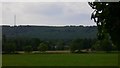
Field south of Fernhurst
Bexleyhill and its mast are in the background.
Image: © Shazz
Taken: 21 Jul 2009
0.19 miles
7
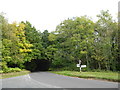
Searching southwards down the Bashire (6a)
Fingerpost just south of Fernhurst
Running total: 7 B points
Image: © Basher Eyre
Taken: 13 Oct 2016
0.21 miles
9
Homelands Copse
A small residential area near the Verdley Place Research Station.
Image: © Dave Spicer
Taken: 2 Jul 2011
0.22 miles
10
Footpath leaves Sewards Copse near Fernhurst
Image: © Shazz
Taken: 21 Jul 2009
0.24 miles