IMAGES TAKEN NEAR TO
Cripplecrutch Hill, HASLEMERE, GU27 2FG
Introduction
This page details the photographs taken nearby to Cripplecrutch Hill, GU27 2FG by members of the Geograph project.
The Geograph project started in 2005 with the aim of publishing, organising and preserving representative images for every square kilometre of Great Britain, Ireland and the Isle of Man.

There are currently over 7.5m images from over14,400 individuals and you can help contribute to the project by visiting https://www.geograph.org.uk
Image Map (Loading...)


Getting Data...Please wait
Leaflet Map data © OpenStreetMap
Images are licensed for reuse under creativecommons.org/licenses/by-sa/2.0
Notes
- Clicking on the map will re-center to the selected point.
- The higher the marker number, the further away the image location is from the centre of the postcode.
Image Listing (18 Images Found)
Images are licensed for reuse under creativecommons.org/licenses/by-sa/2.0
Image
Details
Distance
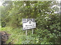
1
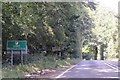
Path signs for the Sussex Border Path and bridleway
Image: © Dave Spicer
Taken: 24 Jan 2010
0.02 miles
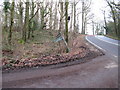
2
Debris by the A283 southbound
Road junction on the brow of a hill on a bend. I was surprised there wasn't more bits of broken cars around
Image: © Dave Spicer
Taken: 24 Jan 2010
0.03 miles
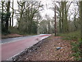
3
T- junction between the B2131 Rodgate Lane and the A283
The B2131 links the A283 with the A286 at Haslemere
Image: © Dave Spicer
Taken: 24 Jan 2010
0.06 miles
4
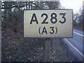
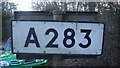
Pre-Worboys sign on A283 entering Surrey on the Sussex border
There is one on the other side saying A283 as well
Image: © David Howard
Taken: 2 Mar 2009
0.07 miles
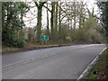
5
Junction between A283 and B2131 at Ramsnest Common, Surrey
Image: © nick macneill
Taken: 7 Oct 2011
0.08 miles
6
Pre-Worboys sign on A283 entering Surrey on the Sussex border
Surrey has kept these signs on their rural A roads, and a number are placed on the borders as soon as you enter the county like this pair.
Image: © David Howard
Taken: 2 Mar 2009
0.08 miles
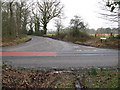
7
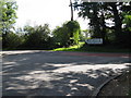
Tee junction between the A283 and B2131
Rodgate Lane and the footpath opposite are part of the Sussex Border Path and the boundary of Surrey to the left and West Sussex.
Image: © Dave Spicer
Taken: 18 Sep 2010
0.08 miles
8
Where am I?
Cripplecrutch Hill, Ramsnest Common
Image: © David Howard
Taken: 26 Jun 2016
0.09 miles
9
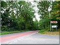
Surrey County border sign on the A283 at Cripplecrutch Hill
Image: © Dave Spicer
Taken: 24 Jan 2010
0.11 miles