IMAGES TAKEN NEAR TO
Pathfields, HASLEMERE, GU27 2BN
Introduction
This page details the photographs taken nearby to Pathfields, GU27 2BN by members of the Geograph project.
The Geograph project started in 2005 with the aim of publishing, organising and preserving representative images for every square kilometre of Great Britain, Ireland and the Isle of Man.

There are currently over 7.5m images from over14,400 individuals and you can help contribute to the project by visiting https://www.geograph.org.uk
Image Map (Loading...)


Getting Data...Please wait
Leaflet Map data © OpenStreetMap
Images are licensed for reuse under creativecommons.org/licenses/by-sa/2.0
Notes
- Clicking on the map will re-center to the selected point.
- The higher the marker number, the further away the image location is from the centre of the postcode.
Image Listing (476 Images Found)
Images are licensed for reuse under creativecommons.org/licenses/by-sa/2.0
Image
Details
Distance
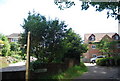
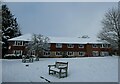
2
A month late, but let's enjoy (44)
Pathfields
Image: © Basher Eyre
Taken: 24 Jan 2021
0.01 miles
3
A month late, but let's enjoy (45)
If you've reached this point on The Greensand Way, you've either done 1 mile or 107 miles!
Image: © Basher Eyre
Taken: 24 Jan 2021
0.01 miles
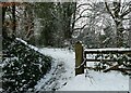
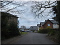
5
Footpath from Cuthbert Row arrives at Church Lane
Image: © Basher Eyre
Taken: 1 Apr 2020
0.03 miles
6
Looking from Fieldway towards Cuthbert Row
Image: © Basher Eyre
Taken: 2 Apr 2020
0.03 miles
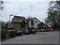
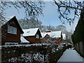
8
A month late, but let's enjoy (43)
Flats behind the Old School
Image: © Basher Eyre
Taken: 24 Jan 2021
0.03 miles
9
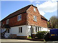
Church Hill Cottage, Church Lane, Haselmere
Renovation in progress. May 2009.
Image: © Erich Wolf
Taken: 8 Apr 2009
0.03 miles
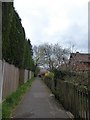
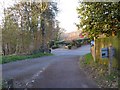
10
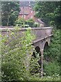
Church Lane
Railway bridge on Church Lane, Haslemere.
Image: © Ben Gamble
Taken: 25 Jun 2005
0.04 miles