IMAGES TAKEN NEAR TO
Lion Lane, HASLEMERE, GU27 1JE
Introduction
This page details the photographs taken nearby to Lion Lane, GU27 1JE by members of the Geograph project.
The Geograph project started in 2005 with the aim of publishing, organising and preserving representative images for every square kilometre of Great Britain, Ireland and the Isle of Man.

There are currently over 7.5m images from over14,400 individuals and you can help contribute to the project by visiting https://www.geograph.org.uk
Image Map (Loading...)


Getting Data...Please wait
Leaflet Map data © OpenStreetMap
Images are licensed for reuse under creativecommons.org/licenses/by-sa/2.0
Notes
- Clicking on the map will re-center to the selected point.
- The higher the marker number, the further away the image location is from the centre of the postcode.
Image Listing (316 Images Found)
Images are licensed for reuse under creativecommons.org/licenses/by-sa/2.0
Image
Details
Distance
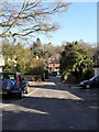
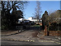
2
Junction of Underdown Road and Lion Lane
Image: © Basher Eyre
Taken: 30 Jan 2010
0.02 miles
3
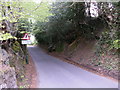
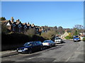
A glorious late January morning in Lion Lane
Image: © Basher Eyre
Taken: 30 Jan 2010
0.03 miles
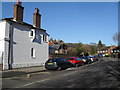
8
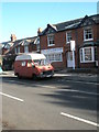
Splendid old camper van outside G.M. Luff & Partners in Lion Lane
Image: © Basher Eyre
Taken: 30 Jan 2010
0.06 miles
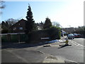
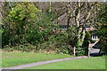
9
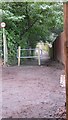
Footpath beyond Vicarage Lane
Vicarage Lane stops here with a turning area. The footpath ahead leads past a school to Lion Lane.
Image: © Shazz
Taken: 12 Feb 2009
0.07 miles