1
2020 vision: Day 202
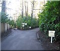
Junction of Tower Road and Pine Way, Hindhead
Temperature 20C
BBC Radio Four, 'The World at One', first headline: China has urged the UK "not to take more steps down the wrong path" by withdrawing from an extradition treaty with Hong Kong
Image: © Basher Eyre
Taken: 20 Jul 2020
0.07 miles
2
Interesting frontages at Heatherbanks
The house on the left dated AD1900 is Heatherbank Cottage. On its right with a clock which was showing the correct time is Heatherbank Stables. The properties are in Tower Road, Hindhead and there was no sign of equines.
Image: © Shazz
Taken: 20 Feb 2009
0.09 miles
3
Hindhead Telephone Exchange, Surrey
Situated down a track off Tower Road, this TE, which has the code THHH, replaced the former Manual TE in Exchange House, Hindhead Road in 1970, http://www.geograph.org.uk/photo/1673162 refers. It provides telephone and broadband services to 2,964 residential and 217 non-residential premises in Hindhead, plus Beacon Hill, Grayshott and Nutcombe nearby. A meerkat soft toy can be seen above the entrance whilst a BT Openreach van is parked to the right. Also, a BT warning notice and a yellow gritsalt bin can be seen to the left of this TE. The numbering range of this TE is (01428) 60xxxx, the (01428) referring to the Haslemere group of eight TEs, and its postcode is GU26 6ST.
Image: © David Hillas
Taken: 28 May 2015
0.10 miles
4
Heather Bank Cottage and Clock Tower
In Tower Road, Hindhead. The cottage is Grade II listed: http://www.britishlistedbuildings.co.uk/en-449585-heather-bank-cottage-haslemere-surrey
Image: © David960
Taken: 3 May 2014
0.10 miles
5
Glenville Gardens
Residential street on the Greensand heights of Hindhead, a village soon to become much quieter after the A3 Hindhead tunnel opens.
Image: © Colin Smith
Taken: 24 Feb 2011
0.11 miles
6
Tower Rd
Image: © N Chadwick
Taken: 11 Jul 2010
0.12 miles
7
Stepping Stones School
Image: © N Chadwick
Taken: 11 Jul 2010
0.13 miles
8
Stepping Stones School, Hindhead
Former United Reformed Church and Hall in Tower Road. Grade II listed: http://www.britishlistedbuildings.co.uk/en-449582-united-reform-church-hall-and-manse-hasl
Image: © David960
Taken: 3 May 2014
0.14 miles
9
Huntington House Drive, Hindhead
Junction with public footpath.
Image: © David960
Taken: 11 Jan 2014
0.14 miles
10
Huntington House Drive, Hindhead
Image: © David960
Taken: 11 Jan 2014
0.14 miles


