
IMAGES TAKEN NEAR TO
Kingswood Firs, HINDHEAD, GU26 6ES
Introduction
This page details the photographs taken nearby to Kingswood Firs, GU26 6ES by members of the Geograph project.
The Geograph project started in 2005 with the aim of publishing, organising and preserving representative images for every square kilometre of Great Britain, Ireland and the Isle of Man.

There are currently over 7.5m images from over14,400 individuals and you can help contribute to the project by visiting https://www.geograph.org.uk
Image Map
Images are licensed for reuse under creativecommons.org/licenses/by-sa/2.0
Notes
- Clicking on the map will re-center to the selected point.
- The higher the marker number, the further away the image location is from the centre of the postcode.
Image Listing (35 Images Found)
Images are licensed for reuse under creativecommons.org/licenses/by-sa/2.0
Image
Details
Distance
1
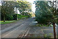
Road at Kingswood Firs
The houses in Grayshott and well spread out, behind high hedges on private roads like this.
Image: © Graham Horn
Taken: 14 Jan 2012
0.05 miles
3
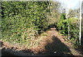
Path at Kingswood Firs
There is a network of paths in the woodland between the spread out houses in this part of Grayshott.
Image: © Graham Horn
Taken: 14 Jan 2012
0.07 miles
5
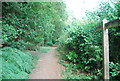
Footpath fingerposts enroute to Grayshott
Image: © N Chadwick
Taken: 11 Jul 2010
0.10 miles
8
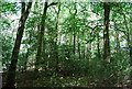
Kingswood Firs
This woodland is just in Hampshire, the photo was taken from Surrey.
Image: © N Chadwick
Taken: 11 Jul 2010
0.11 miles
9
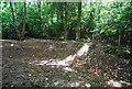
A depression in the woods south of Grayshott
Possibly an old quarry, for the local sandstone?
Image: © N Chadwick
Taken: 11 Jul 2010
0.12 miles
10
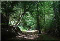
Footpath along the Hampshire - Surrey border
The path marks the Surrey (left), Hampshire (right) border.
Image: © N Chadwick
Taken: 11 Jul 2010
0.13 miles