
IMAGES TAKEN NEAR TO
Sandy Lane, VIRGINIA WATER, GU25 4TG
Introduction
This page details the photographs taken nearby to Sandy Lane, GU25 4TG by members of the Geograph project.
The Geograph project started in 2005 with the aim of publishing, organising and preserving representative images for every square kilometre of Great Britain, Ireland and the Isle of Man.

There are currently over 7.5m images from over14,400 individuals and you can help contribute to the project by visiting https://www.geograph.org.uk
Image Map
Images are licensed for reuse under creativecommons.org/licenses/by-sa/2.0
Notes
- Clicking on the map will re-center to the selected point.
- The higher the marker number, the further away the image location is from the centre of the postcode.
Image Listing (37 Images Found)
Images are licensed for reuse under creativecommons.org/licenses/by-sa/2.0
Image
Details
Distance
1
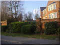
Flats on Sandhills Lane Virginia Water
Image: © David Howard
Taken: 20 Mar 2011
0.07 miles
2
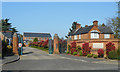
St Ann's Park, Virginia Water
Another gated settlement near Virginia Water station.
Image: © Des Blenkinsopp
Taken: 6 Apr 2017
0.07 miles
3
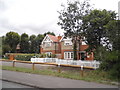
Houses on The Gardens by Sandhills Road
The houses and access have been recently renovated from derelict a few years earlier.
Image: © David Howard
Taken: 27 Jul 2015
0.08 miles
4
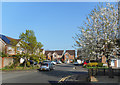
The Orchard, Virginia Water
Featuring a cherry tree, which seems appropriate.
New housing near Virginia Water station.
Image: © Des Blenkinsopp
Taken: 6 Apr 2017
0.09 miles
5
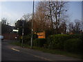
Sandhills Lane Virginia Water
At junction of Stroude Road
Image: © David Howard
Taken: 20 Mar 2011
0.09 miles
6
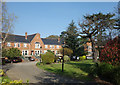
Sandy Lane, Virginia Water
The north end of Sandy Lane consists of a ring of houses around a central garden.
Image: © Des Blenkinsopp
Taken: 6 Apr 2017
0.12 miles
7
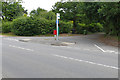
Trumps Mill Lane
The junction of Trumps Mill Lane, an access road to Trumps Mill, with Sandhills Lane near Virginia Water.
Image: © Alan Hunt
Taken: 25 Jun 2015
0.14 miles
8
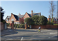
Gates onto Stroude Road
Closing off your road with big gates is quite fashionable round here.
I sometimes wish we could do it down our road, except I know I'd forget the entry code....
Image: © Des Blenkinsopp
Taken: 6 Apr 2017
0.15 miles
9
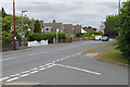
Houses along Sandhills Lane
Houses along the north side of Sandhills Lane from the junction of Trumps Mill Lane.
Image: © Alan Hunt
Taken: 25 Jun 2015
0.15 miles
10
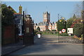
The Old Sanatorium
The former Holloway Sanatorium was built between 1873 - 1885 under the patronage of Thomas Holloway, a wealthy philanthropist who had made a fortune from Patent Medicines.
Following closure by the NHS it was converted to housing and is now called Virginia Park.
Wiki. page on Holloway Sanatorium :- https://en.wikipedia.org/wiki/Holloway_Sanatorium
Only the gates are in this square, the buildings are in TQ0068.
Image: © Des Blenkinsopp
Taken: 6 Apr 2017
0.16 miles