IMAGES TAKEN NEAR TO
Pinewood Road, VIRGINIA WATER, GU25 4PA
Introduction
This page details the photographs taken nearby to Pinewood Road, GU25 4PA by members of the Geograph project.
The Geograph project started in 2005 with the aim of publishing, organising and preserving representative images for every square kilometre of Great Britain, Ireland and the Isle of Man.

There are currently over 7.5m images from over14,400 individuals and you can help contribute to the project by visiting https://www.geograph.org.uk
Image Map
Images are licensed for reuse under creativecommons.org/licenses/by-sa/2.0
Notes
- Clicking on the map will re-center to the selected point.
- The higher the marker number, the further away the image location is from the centre of the postcode.
Image Listing (9 Images Found)
Images are licensed for reuse under creativecommons.org/licenses/by-sa/2.0
Image
Details
Distance
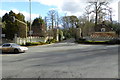
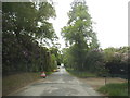
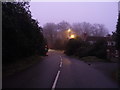
2
Pinewood Road at the junction of Wentworth Drive
Image: © David Howard
Taken: 31 May 2015
0.13 miles
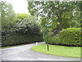
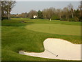
4
Pinewood Road, Wentworth
The azaleas are in full bloom as are the builders, many of the plots are building sites.
Image: © David Howard
Taken: 31 May 2015
0.17 miles
5
Portnall Road at the junction of Wentworth Drive
Image: © David Howard
Taken: 13 Dec 2015
0.19 miles
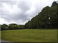
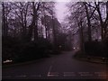
6
Wentworth Drive
Wentworth Drive leads to Wentworth golf course and private housing estate from the A30. The course is surrounded by a network of residential roads.
Image: © David Howard
Taken: 13 Dec 2015
0.23 miles
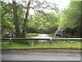
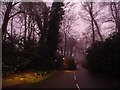
8
Wentworth Drive looking towards the A30
Image: © David Howard
Taken: 13 Dec 2015
0.24 miles