IMAGES TAKEN NEAR TO
Callow Hill, VIRGINIA WATER, GU25 4LW
Introduction
This page details the photographs taken nearby to Callow Hill, GU25 4LW by members of the Geograph project.
The Geograph project started in 2005 with the aim of publishing, organising and preserving representative images for every square kilometre of Great Britain, Ireland and the Isle of Man.

There are currently over 7.5m images from over14,400 individuals and you can help contribute to the project by visiting https://www.geograph.org.uk
Image Map
Images are licensed for reuse under creativecommons.org/licenses/by-sa/2.0
Notes
- Clicking on the map will re-center to the selected point.
- The higher the marker number, the further away the image location is from the centre of the postcode.
Image Listing (18 Images Found)
Images are licensed for reuse under creativecommons.org/licenses/by-sa/2.0
Image
Details
Distance
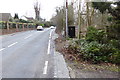
6
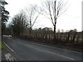
The entrance to Royal Holloway University, Huntersdale
The main campus is along the road on the A30 nearby
Image: © David Howard
Taken: 14 Dec 2014
0.11 miles
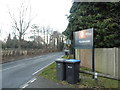
9
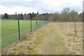
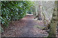
The way to the woods
School playing fields are on the left.
Image: © Shazz
Taken: 21 Feb 2015
0.15 miles
10
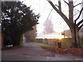
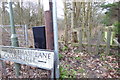
Access road to houses off Bakeham Lane
The lit up building is a greenhouse but wasn't easy to see in the dark and misty conditions.
Image: © David Howard
Taken: 13 Dec 2015
0.19 miles