IMAGES TAKEN NEAR TO
Tithe Meadows, VIRGINIA WATER, GU25 4EU
Introduction
This page details the photographs taken nearby to Tithe Meadows, GU25 4EU by members of the Geograph project.
The Geograph project started in 2005 with the aim of publishing, organising and preserving representative images for every square kilometre of Great Britain, Ireland and the Isle of Man.

There are currently over 7.5m images from over14,400 individuals and you can help contribute to the project by visiting https://www.geograph.org.uk
Image Map
Images are licensed for reuse under creativecommons.org/licenses/by-sa/2.0
Notes
- Clicking on the map will re-center to the selected point.
- The higher the marker number, the further away the image location is from the centre of the postcode.
Image Listing (20 Images Found)
Images are licensed for reuse under creativecommons.org/licenses/by-sa/2.0
Image
Details
Distance
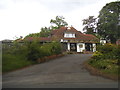
1
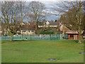
Trumps Green
The tennis courts on the King George V recreation Ground
Image: © Alan Hunt
Taken: 5 Apr 2010
0.10 miles
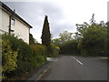
3
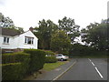
Harpesford Avenue at the junction of Crown Road
Image: © David Howard
Taken: 31 May 2015
0.11 miles
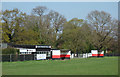
5
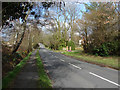
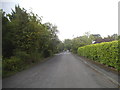
Trumps Green Road
View along Trumps Green Road. This road runs from Virginia Water towards Longcross and Chobham. The King George V recreation ground is on the left side of the road.
Image: © Alan Hunt
Taken: 5 Apr 2010
0.14 miles
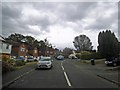
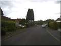
6
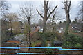
Houses by the railway line, Trumps Green
Image: © N Chadwick
Taken: 13 Feb 2016
0.15 miles